Machine Generated Data
Tags
Color Analysis
Feature analysis
Amazon
| Poster | 74% | |
Categories
Imagga
| text visuals | 97.2% | |
| streetview architecture | 1.2% | |
| events parties | 0.8% | |
| cars vehicles | 0.4% | |
| nature landscape | 0.2% | |
| interior objects | 0.1% | |
Captions
Microsoft
created on 2018-03-22
| a black and silver text on a white background | 65.3% | |
| a black and silver text | 65.2% | |
| a close up of text on a black background | 65.1% | |
Anthropic Claude
Created by claude-3-haiku-20240307 on 2024-12-29
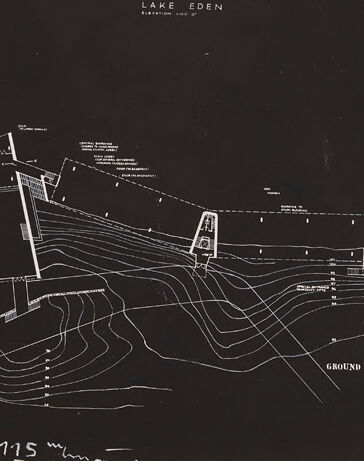
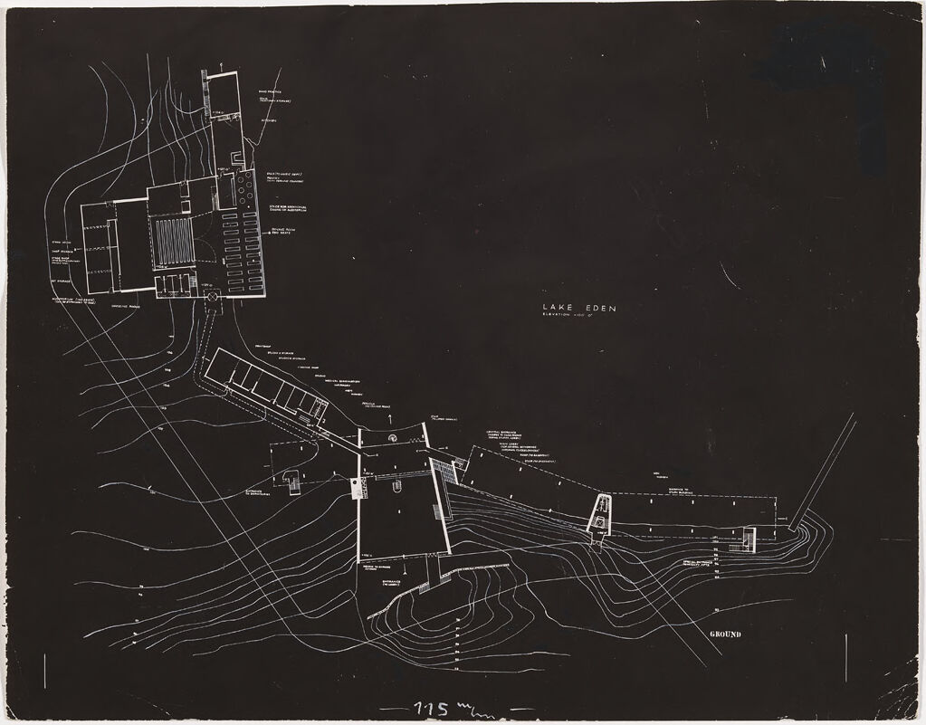
This image appears to be an architectural or engineering drawing or blueprint. It shows a detailed map or plan of a complex, likely consisting of several buildings or structures. The drawing features various lines, shapes, and labels that indicate the layout and features of the site, which seems to be situated near a body of water labeled "Lake Eden". The overall style and presentation suggests this is a technical or planning document rather than a general map or illustration.
Created by claude-3-opus-20240229 on 2024-12-29
The image shows a detailed architectural site plan or blueprint of Lake Eden, likely a proposed development or existing layout. The plan depicts various structures, roads, pathways, and landscape features in white lines against a black background. The main focal point appears to be a central lake or water body labeled "LAKE EDEN". Surrounding this are several buildings of different sizes and configurations, connected by a network of curving roads and walkways that follow the natural contours of the site. Smaller details like parking areas, individual trees or landscaping, and what seem to be docks or waterfront structures along the lake edge are also indicated. Overall the plan has an organic, flowing layout that suggests a thoughtfully designed integration of the built environment with the natural landscape setting.
Created by claude-3-5-sonnet-20241022 on 2024-12-29
This appears to be an architectural site plan or blueprint drawn in white lines on a black background. The drawing shows what seems to be a lakeside development labeled "LAKE EDEN." The plan includes topographical contour lines indicating the terrain's elevation changes, and various building footprints and structures laid out along what appears to be a sloping site. The buildings are connected by pathways or roads, and the layout follows the natural contours of the land. In the upper portion of the drawing, there appears to be a larger building complex, possibly with a pool or rectangular feature. The drawing has a technical, precise quality typical of architectural drawings from mid-20th century design documentation.
Text analysis
Amazon