Machine Generated Data
Tags
Color Analysis
Feature analysis
Amazon

| Poster | 57.1% | |
Categories
Imagga
| text visuals | 89.1% | |
| paintings art | 6.9% | |
| streetview architecture | 3.9% | |
Captions
Microsoft
created on 2019-06-05
| a close up of a map | 81.6% | |
| close up of a map | 78.9% | |
| a map with text | 69.5% | |
Clarifai
created by general-english-image-caption-blip on 2025-05-20
| a photograph of a plan of a plan of a plan of a plan of a plan of a | -100% | |
Google Gemini
Created by gemini-2.0-flash-lite on 2025-04-30
Here's a description of the image:
Overall: The image is a detailed plan of a residential development called "Lordship Development." It is drawn in a classic architectural style with precise lines and labels. The plan focuses on the layout of buildings, streets, and landscaping.
Key Elements:
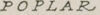
- Streets: The development has winding streets named Grove, Poplar, and Street.
- Buildings: There are rows of houses/buildings, with different building types indicated by letters (A, B, C).
- Landscaping: The plan includes a "Slight Depression" area reserved for garages. Trees are strategically placed along the streets, adding a green element.
- Area Layout: A small inset shows the original layout of the area, with property divisions and dimensions.
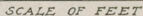
- Scale: The plan includes a "Scale of Feet" to measure distances within the development.
- Numbering: There are numbered markers around the perimeter of the plan, likely for reference or identification.
Style and Context: The image likely represents an architectural or land planning document from the early to mid-20th century. The style is detailed and emphasizes the functional aspects of the development.
Created by gemini-2.0-flash on 2025-04-30
Here's a description of the image based on the provided information:
Overall:
The image is a black and white plan, titled "Plan of Lordship Development," showing a proposed residential layout. It has a geometric form, resembling a triangle with rounded corners. There is also a smaller inset, labeled "Original Layout of Area," depicting a prior division of land.
Detailed Elements:
- Streets: The development is bordered by multiple streets, labeled: Grove Street (top), Poplar Street (bottom), and streets designated by numbers (31, 32, 34, 35, 36). The streets have curved edges lined with dots, likely representing trees.
- Houses: Numerous houses (labeled A, B, and C) are drawn in solid black with white outlines, and are laid out on the site. They appear to be different types, as suggested by the different letters that they are labeled with.
- Garage Space: A designated area labeled "Slight Depression Reserved for Garages" is drawn as a circular space, containing curly lines, possibly indicating trees or bushes.
- Scale: A horizontal scale indicating measurement in feet, ranging from 0 to 200, is located in the top center of the image.
- Original Layout Inset: The "Original Layout of Area" shows how the land was originally divided into a series of rectangular plots of varying sizes.
- Compass Rose: To the right of the "Original Layout Inset," there is a compass rose.
- Miscellaneous Numbers: Several numbers (26, 28, 30, 265) are scattered on the edges of the plan. These likely represent property markers or other identifiers related to the layout.
Text analysis
Amazon