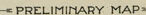
PRELIMINARY MAP-
AC
-or-
FAIRFIELD
ALABAMA
MEADE& HUEY OHAM, ALA
ceo MILLER
ENGINEERS
sCAPE ARCHYECT
e
BSALE OF FEET
ング
HOTE
LAT1
THIS 3 A PRELIMIMARY M A e
SNMINGHAM
TA
HOr NOTICE
GAPEAT
2 ---1-1- 1 - .A
THIS I5 A TRUE CORECT MAP
レービ
TT
ABOVE
MEADE AHY ENGRS
as
--1-1-/AD
LL
34
2
29
.
AMERV0ANa & er co
AMERICAN STEEL AND WIRE Co
4.000po0 PLANT
RE RANWAY
FASO S5TEP
aEwC 300 THE R RAWAY
-NOTICE-
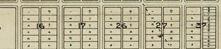
THE LOT
THIS MARARE NO NUMBERS SHOWN ON
MAD FOR CORRECT LOTAND BLOCK NUMBERS.
ON WHICH ALL PRICES ARE MADE AND
ON WHICH ALL SALES WILL BE BASED.
..
HARBISOM-WALKER REFRACTORIES Co
TC.1&RR Cos
DAS
#4.000000 DY-PRODUCT PLANT
FFICE
イさん
a
MAn
ATEN