Machine Generated Data
Tags
Color Analysis
Feature analysis
Amazon
| Book | 82.7% | |
Categories
Imagga
| text visuals | 95.6% | |
| paintings art | 3.8% | |
Captions
Microsoft
created on 2019-06-05
| a close up of text on a white background | 73% | |
| a close up of text on a black background | 67.9% | |
| a close up of text on a white surface | 67.8% | |
Clarifai
created by general-english-image-caption-blip on 2025-05-03
| a photograph of a map of kansas city, kansas, showing the location of the city | -100% | |
Google Gemini
Created by gemini-2.0-flash on 2025-04-28
Here is a description of the image:
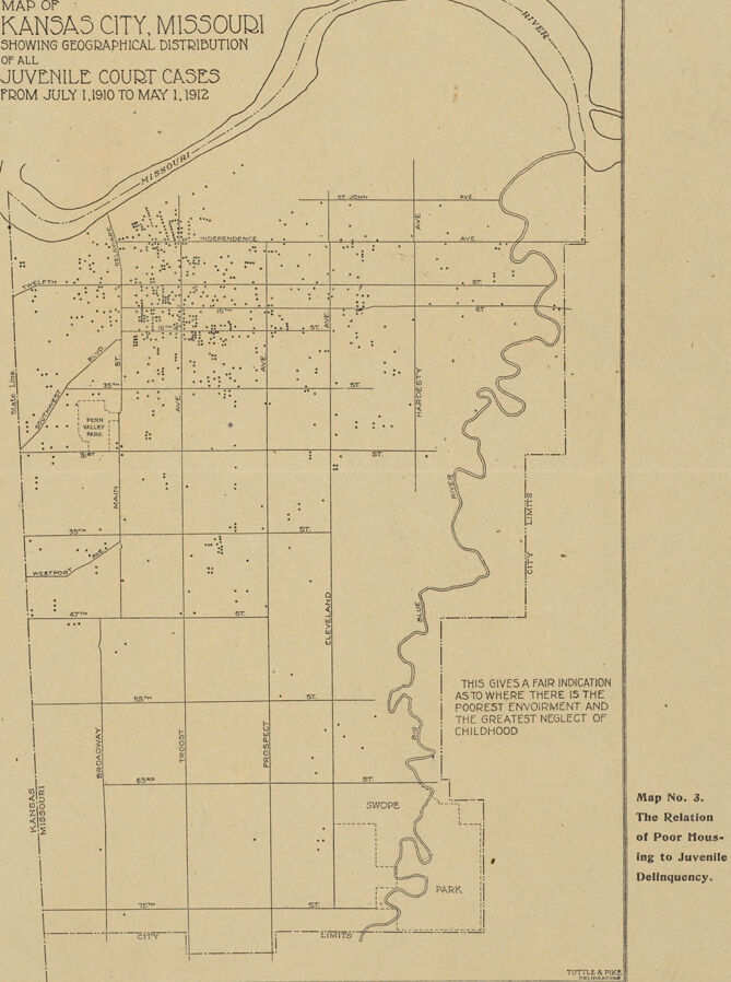
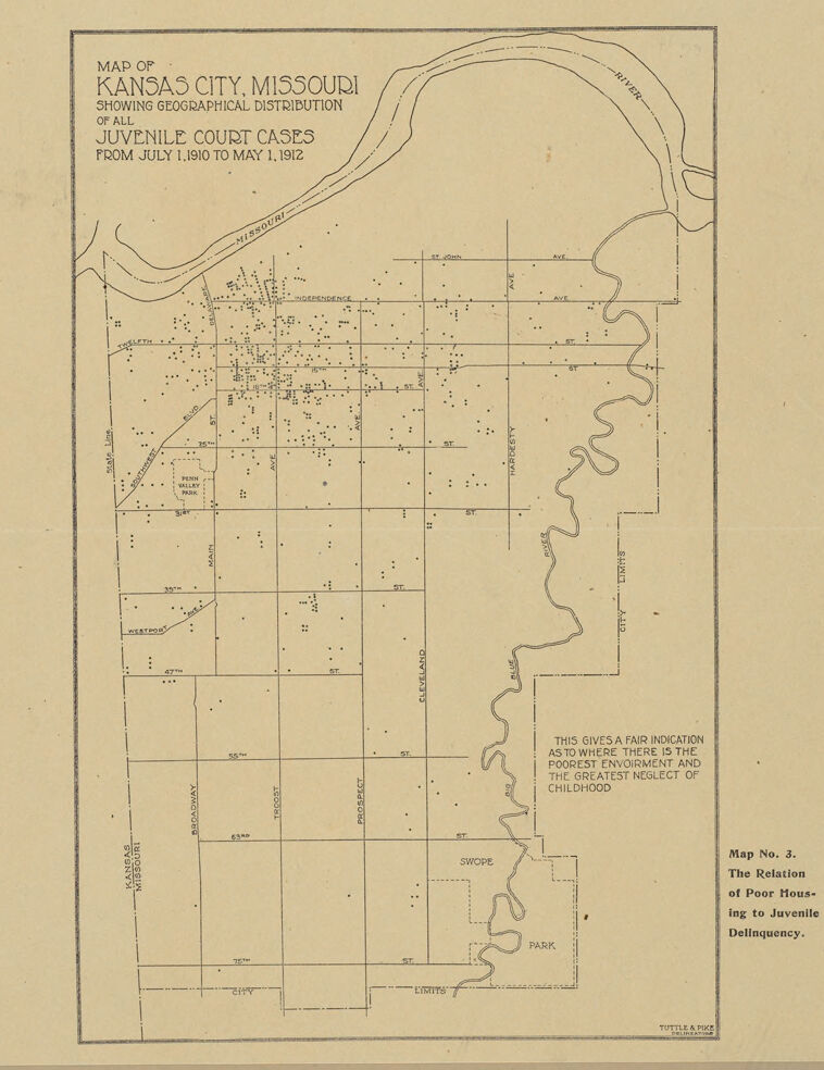
The image is a map titled "Map of Kansas City, Missouri Showing Geographical Distribution of all Juvenile Court Cases from July 1, 1910 to May 1, 1912". The map shows the layout of Kansas City with streets, avenues, the Missouri River, and city limits marked. Small dots are scattered across the map, representing the locations of juvenile court cases. Some streets are labeled, such as Independence Avenue, Twelfth Street, 39th Street, 47th Street, 63rd Street, and 75th Street.
In the lower right corner, there is a note that reads: "This gives a fair indication as to where there is the poorest environment and the greatest neglect of childhood". The map is labeled as "Map No. 3. The Relation of Poor Housing to Juvenile Delinquency". At the very bottom, the map is credited to Tuttle & Pike.
Created by gemini-2.0-flash-lite on 2025-04-28
This is a historical map of Kansas City, Missouri, showing the geographical distribution of juvenile court cases from July 1, 1910, to May 1, 1912. The map highlights the areas where juvenile delinquency was most prevalent, with dots representing the concentration of cases. It appears to be a sociological or geographical study of the time, designed to illustrate the correlation between poverty, environment, and juvenile delinquency. The map includes street names, geographical features such as the Missouri River and the "City Limits," and the text notes that the map is showing areas with the "poorest environment and the greatest neglect of childhood." There's a title in the corner which notes the map is about the relationship of poor housing to juvenile delinquency.
Text analysis
Amazon