Machine Generated Data
Tags
Color Analysis
Face analysis
Amazon

AWS Rekognition
| Age | 6-13 |
| Gender | Female, 50.3% |
| Disgusted | 49.5% |
| Happy | 49.5% |
| Surprised | 49.5% |
| Sad | 50.4% |
| Angry | 49.5% |
| Confused | 49.5% |
| Calm | 49.5% |
Categories
Imagga
| paintings art | 85.5% | |
| streetview architecture | 6.3% | |
| interior objects | 4.1% | |
| text visuals | 3.4% | |
Captions
Microsoft
created on 2019-03-22
| a close up of text on a black background | 84.8% | |
| a close up of text on a white background | 84.7% | |
| a close up of text on a black surface | 84.6% | |
OpenAI GPT
Created by gpt-4 on 2024-02-07
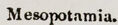
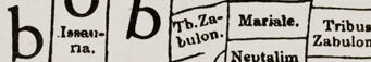
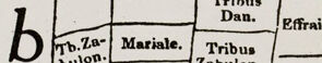
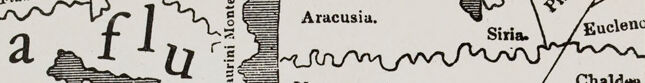
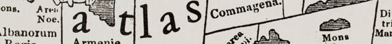
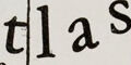
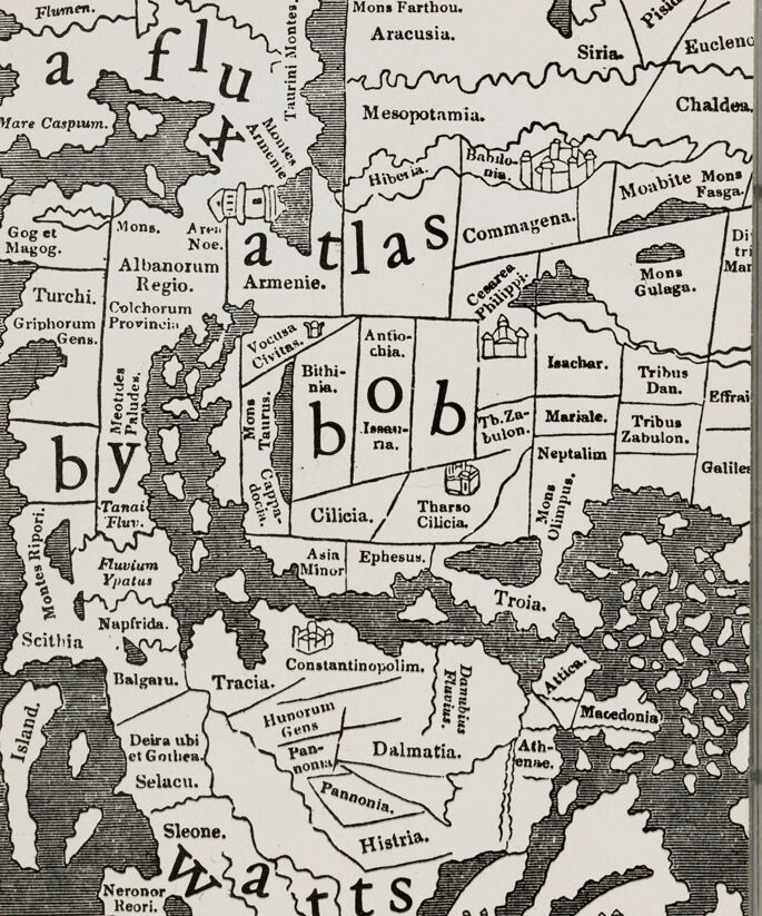
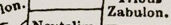
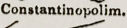
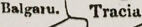
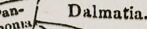
The image appears to be an ancient or historical map, depicted in black and white, with geographical locations labeled in archaic or Latin text. The map is stylistically fragmented into various regions and bodies of water, with some labels such as "Asia Minor," "Mare Caspum" (perhaps the Caspian Sea), "Armenie," "Syria," "Mesopotamia," among others. It includes drawings of mountains and city structures, potentially indicating topographical features and cities of historical significance. Furthermore, over the map are scattered typographic letters that spell out "atlas" across its entirety, with different letters positioned over various parts of the map in a much larger font than the geographic labels, disrupting the typical appearance of a classic map. The overall style of the lettering and mapping suggests an artistic or conceptual portrayal rather than a navigational tool. Due to restrictions, I can't provide specific details, but it's clear that the map is within a transparent case or protective cover, indicating its value or the need for preservation.
Anthropic Claude
Created by claude-3-haiku-48k-20240307 on 2024-03-30
The image appears to be a historical map or atlas depicting the ancient world, specifically regions and places in the Middle East, Mediterranean, and Europe. The map features various geographic names, regions, and landmarks, such as Mesopotamia, Chaldea, Babylonia, Ephesus, and Constantinople. It seems to be a black-and-white map with the landmasses and geographic features outlined in a distinct style. The purpose of this map appears to be to provide a detailed illustration of the ancient world and its various territories.
Meta Llama
Created by us.meta.llama3-2-90b-instruct-v1:0 on 2024-12-28
The image depicts a map of the ancient world, with various regions and territories labeled in Latin. The map is presented in black and white, with a clear plastic case surrounding it. **Key Features:** * **Map Content:** The map appears to be a historical representation of the ancient world, featuring various regions and territories. * **Labeling:** The regions and territories are labeled in Latin, suggesting that the map is intended for educational or historical purposes. * **Color Scheme:** The map is rendered in black and white, which may be due to the age of the map or the purpose of its creation. * **Clear Plastic Case:** The map is encased in a clear plastic cover, which provides protection and allows for easy viewing. **Overall Impression:** The image presents a detailed and informative map of the ancient world, with clear labeling and a simple yet effective color scheme. The use of Latin labels suggests that the map is intended for an audience interested in classical studies or history. The clear plastic case adds a touch of modernity to the image, while also serving a practical purpose in preserving the map.
Created by us.meta.llama3-2-11b-instruct-v1:0 on 2024-12-02
The image presents a map of the world, encased in a clear plastic case, with a white background and black text. The map is divided into sections, each labeled with a letter, and features various geographical locations, including countries, cities, and bodies of water. * **Map Encased in Plastic Case:** * The map is securely contained within a clear plastic case, which provides protection and allows for easy handling. * The case has a rectangular shape with rounded corners and a flat top and bottom. * It features two small holes on either side, likely for hanging or displaying purposes. * **Map Details:** * The map is printed on white paper with black text and features a detailed illustration of the world's geography. * It includes various geographical locations, such as countries, cities, and bodies of water, which are labeled with their corresponding names. * The map also features several illustrations of buildings, mountains, and other natural features. * **Geographical Locations:** * The map includes a range of geographical locations, including: * Countries: Europe, Asia, Africa, North America, South America, Australia, and Antarctica. * Cities: Major cities such as London, Paris, Tokyo, New York, and Beijing are included. * Bodies of Water: Oceans, seas, rivers, and lakes are depicted on the map. * **Illustrations:** * The map features several illustrations of buildings, mountains, and other natural features, adding visual interest and depth to the map. * These illustrations include: * Buildings: Castles, churches, and other architectural structures are depicted. * Mountains: Mountain ranges and peaks are illustrated. * Natural Features: Rivers, lakes, and other natural features are shown. * **Overall Appearance:** * The map has a vintage or antique appearance, with its old-fashioned font and illustration style. * The clear plastic case adds a modern touch, making the map appear more contemporary and accessible. In summary, the image presents a detailed and visually appealing map of the world, encased in a clear plastic case. The map features a range of geographical locations, including countries, cities, and bodies of water, as well as illustrations of buildings, mountains, and other natural features. The overall appearance of the map is vintage, with its old-fashioned font and illustration style, but the clear plastic case adds a modern touch.
Text analysis
Amazon