Machine Generated Data
Tags
Color Analysis
Face analysis
Amazon

AWS Rekognition
| Age | 33-49 |
| Gender | Male, 54.9% |
| Fear | 45% |
| Angry | 45.1% |
| Surprised | 45% |
| Confused | 45% |
| Calm | 53.9% |
| Sad | 45.9% |
| Disgusted | 45% |
| Happy | 45% |
Feature analysis
Amazon
Clarifai
AWS Rekognition
| Passport | 60.7% | |


Categories
Imagga
created on 2019-11-06
| text visuals | 99.9% | |
Captions
Microsoft
created by unknown on 2019-11-06
| a close up of text on a white background | 68.5% | |
| a close up of text on a white surface | 64.3% | |
| a close up of text on a black background | 60.6% | |
Clarifai
Created by general-english-image-caption-clip on 2025-07-14
a map of the world.
Salesforce
Created by general-english-image-caption-blip on 2025-05-25
a photograph of a diagram of the earth's crust of the earth
OpenAI GPT
Created by gpt-4o-2024-05-13 on 2025-02-02
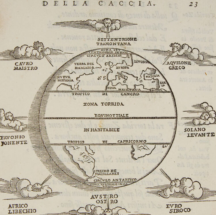
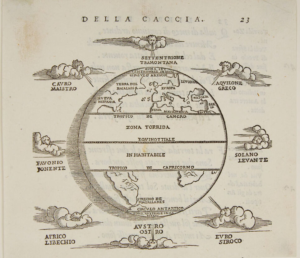
The image is an antique illustration depicting a world map divided into zones and accompanied by depictions of the winds. The map uses an old cartographic style and labels various geographical regions and climatic zones.
Key features of the illustration include:
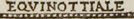
- A circular world map divided by the Equator (labeled as "Equinoctiale") and Tropics (Tropic of Cancer and Tropic of Capricorn).
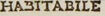
- The map identifies a "Zona Torrida" (Torrid Zone) around the Equator, "Zona Setentrionale Inhab." (Northern Inhabitable Zone), "Provincia Frigida Mavri" (Cold Province of the Moors), and "Zona Australe Inhab." (Southern Inhabitable Zone).
- The continents shown include parts labeled as "Europaa," "Natolia," "Fessa Mavri," "Novo Hispania," and "Terra del Bacalaos."
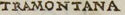
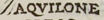
- Marginal illustrations of wind deities blowing from various directions, named in Italian: "Cavro Maistro" (probably Northwest), "Settentrione Tramontana" (North), "Aquilone Greco" (Northeast), "Solano Levante" (East), "Evro Siroco" (Southeast), "Austro Ostrio" (South), "Aerico Libechio" (Southwest), and "Favonio Ponente" (West).
- The map is likely from a historical European document, given the style and Italian text, and appears on page numbered 23 with the title "DELLA CACCIA" at the top.
This illustration represents an early understanding of the world and wind patterns, providing insight into how people viewed geography and climate zones in historical times.
Created by gpt-4 on 2025-02-02
The image appears to be an old map or a diagram with inscriptions in Italian, showing the traditional representation of wind directions and possibly delineations of climatic zones. It's a circular diagram, divided into bands with labeled areas and surrounded by clouds and wind faces, which are personifications of the various winds blowing from different directions.
At the top of the image, the title reads "DELLA CACCIA," followed by the number "23," potentially indicating this is page 23 of a document or book on the subject titled "Della Caccia" (Of Hunting). The central circular diagram is segmented into labeled sections such as "TERRA DEL BACALAOS," "TROPICO DI CANCRO," "ZONA TORRIDA," and "IN ABITABILE," signaling geographical regions.
Surrounding the circle are various classical names for winds, including "CAVRO MAISTRO," "AQUILONE GRECO," and "EVRO SIROCO," each depicted with a small cherubic face blowing air from the clouds, indicating the direction the wind comes from—a common feature in Renaissance and earlier maps.
The diagram seems to blend geographical concepts with the symbolic representation of winds akin to those found in older cartographic and climatological illustrations.
Anthropic Claude
Created by claude-3-5-sonnet-20241022 on 2025-02-02
This is a historical map titled "DELLA CACCIA" (Of Hunting) showing an early cartographic representation of the world. The map features a hemispheric projection with various geographical zones marked, including "ZONA TORRIDA" (Torrid Zone) and "IN HABITABILE" (Uninhabitable). Around the circular map are eight wind directions represented by classical wind heads blowing clouds, each labeled with their Italian and classical names:
- Settentrione Tramontana (North)
- Aquilone Greco (Northeast)
- Solano Levante (East)
- Euro Siroco (Southeast)
- Austro Ostro (South)
- Africo Libechio (Southwest)
- Favonio Ponente (West)
- Cauro Maistro (Northwest)
The map includes basic continental outlines and shows features like "NUOVA HISPANIA" (New Spain), "EUROPA," "MAURITANIA," and the "ESTRECHO DE MAGALLANES" (Strait of Magellan). The drawing style is characteristic of Renaissance-era cartography, with decorative elements and Latin terminology.
Created by claude-3-opus-20240229 on 2025-02-02
The image depicts an old black and white engraving or illustration of a map titled "Della Caccia" from page 23 of an unknown work. The map shows a circular representation of the Earth divided into different zones and regions, with labels in Italian.
Some of the labeled regions on the map include "Zona Torrida" (Torrid Zone) around the equator, as well as "Favonio Ponente" and "Solano Levante" near the top and bottom. Other labels mark the Tropic of Cancer and Tropic of Capricorn, and the polar circles are shown at the very top and bottom.
Decorative scrollwork embellishments frame the circular map on all sides. The overall style suggests this is a reproduction of a map engraving from the 16th-18th century, perhaps from an encyclopedia or geographical treatise published in Italy during that time period.
Created by claude-3-haiku-20240307 on 2025-02-02
This image appears to be a historical map or diagram depicting the divisions and geographical features of the world according to some conceptual framework. It shows various regions and labels them with names such as "Settentrione", "Zona Torrida", "Favonio Ponente", and "Solano Levante". The map also features some whimsical cloud-like illustrations around the edges. Overall, the image seems to be an illustrated representation of a cosmological or geographic worldview from a historical perspective.
Created by us.anthropic.claude-3-5-sonnet-20241022-v2:0 on 2025-06-25
This is a historical map or diagram titled "DELLA CACCIA" (meaning "Of the Hunt" in Italian). It appears to be from an old text and shows a hemispheric projection of the Earth with various wind directions and geographical zones marked on it. The map includes labels for different regions like "ZONA TORRIDA" (Torrid Zone), "EQUINOTTIALE" (Equatorial), and "CIRCULO ANTARTICO" (Antarctic Circle).
Around the perimeter of the map are labels for different winds in Italian, including:
- Tramontana (North wind)
- Greco (Northeast wind)
- Levante (East wind)
- Sirocco (Southeast wind)
- Austro (South wind)
- Libeccio (Southwest wind)
- Ponente (West wind)
- Maestro (Northwest wind)
The map also shows some geographical features and place names, including the Strait of Magellan ("STRECHO DE MAGALLANES") and various regions of the known world at the time. The illustration includes decorative clouds or wind faces around the edges, which was a common cartographic style element in historical maps.
Meta Llama
Created by us.meta.llama3-2-11b-instruct-v1:0 on 2025-03-16
The image depicts an old, yellowed map of the world, with a circular shape and a central section labeled "ZONA TORRIDA." The map is surrounded by various illustrations, including clouds, mountains, and a cherub-like figure. The text on the map is written in Italian, with some words and phrases appearing to be in Latin.
Here are the main points of the image:
- Map Title: The title of the map is "DELLA CACCIA," which translates to "Of the Hunt" in English.
- Central Section: The central section of the map is labeled "ZONA TORRIDA," which means "Torrid Zone" in English. This section appears to represent the equatorial region of the Earth.
- Surrounding Text: The surrounding text on the map includes various place names, such as "CAVRO MAISTRO," "AQVILONE GRECO," and "SOLANO LEVANTE." These names are likely references to specific locations or regions on the map.
- Illustrations: The map features several illustrations, including clouds, mountains, and a cherub-like figure. These illustrations may be intended to represent natural features or symbols associated with the map's content.
- Language: The text on the map is written in Italian, with some words and phrases appearing to be in Latin. This suggests that the map was created for an audience familiar with these languages.
- Age: The map appears to be quite old, with a yellowed and worn appearance. This suggests that it may have been created in the 16th or 17th century.
Overall, the image provides a glimpse into an old map of the world, with its unique illustrations and text offering insights into the cartography and language of the time.
Created by us.meta.llama3-2-90b-instruct-v1:0 on 2025-03-16
The image depicts a vintage-style map of the world, with a central focus on the globe and its various regions. The title "DELLA CACCIA" is prominently displayed at the top, accompanied by the number "23" in the upper-right corner.
Key Features:
- Globe: The globe is divided into sections, each labeled with a specific region or zone.
- Regions: The regions are identified by their names, such as "TERRA DEL BACALAO" and "ZONA TORRIDA".
- Clouds: Clouds are depicted around the globe, adding a sense of depth and atmosphere to the image.
- Text: The text is written in an old-fashioned font, giving the image a sense of age and authenticity.
- Background: The background of the image is a light beige color, which helps to create a sense of warmth and nostalgia.
Overall Impression:
The image presents a unique and fascinating view of the world, with its vintage-style map and detailed labeling of regions. The use of clouds and text adds depth and context to the image, making it a compelling and informative visual representation of the globe.
Amazon Nova
Created by amazon.nova-pro-v1:0 on 2025-02-02
The image is a historical map of the world, titled "DELLA CACCIA." The map is divided into different sections and labeled with various geographical names. The map appears to be from an old book or atlas, as it has a vintage look and feel. The map shows the continents of Europe, Asia, Africa, North America, South America, and Antarctica. The map also includes the names of different regions, such as the Mediterranean Sea, the Indian Ocean, and the Pacific Ocean. The map is surrounded by decorative elements, such as clouds and figures, which add to its aesthetic appeal.
Created by amazon.nova-lite-v1:0 on 2025-02-02
The image is an antique map of the world, titled "Della Caccia," which translates to "Of the Hunt" in English. The map is drawn in black and white and shows various regions and landmarks. It includes the names of different regions, such as "Zona Torrida" (Torrid Zone), "Zona Equinottiale" (Equatorial Zone), and "Zona Inabitabile" (Uninhabitable Zone). The map also features illustrations of wind directions and their effects on the regions. The title and text are written in Italian, and the map is surrounded by a decorative border.
Google Gemini
Created by gemini-2.0-flash on 2025-05-20
Here's a description of the image you sent, focusing on the key elements:
Overall Impression:
The image is a detailed, black-and-white illustration resembling a vintage map or diagram. It seems to depict a world view with specific geographical zones, wind directions, and allegorical figures. The overall style is reminiscent of early cartography and scientific illustration.
Central Focus - The Earth:
- A stylized representation of the Earth occupies the central area.
- Horizontal lines divide the globe into zones:
- "ZONA SETTENTRIONALE IN HABIT CIRCVLO ARTICO"
- "TROPICO DI CANCRO"
- "ZONA TORRIDA"
- "EQVINOTTIALE"
- "IN HABITABILE"
- "TROPICO DI CAPRICORNO"
- "CIRCULO ANTARTICO ZONA AVSTRALE IN HA"
- Landmasses are present, including recognizable shapes of Europe, South America, and Africa.
- Geographical locations are labeled, such as "EVROPA," "ITALIA," "EGITTO," "MAVRITANIA," "NVEVA HISPANIA," "TERRA DEL BACALAOS," "LIVONIA," and "NATOLIA."
Wind Representations:
- Around the perimeter of the Earth, cherubic figures blowing winds are depicted.
- Each figure is associated with a direction and a name:
- "CAVRO MAISTRO"
- "SETTENTRIONE TRAMONTANA"
- "AQVILONE GRECO"
- "SOLANO LEVANTE"
- "EVRO SIROCO"
- "AVSTRO OSTRO"
- "AFRICO LIBECHIO"
- "FAVONIO PONENTE"
Text and Layout:
- The text "DELLA CACCIA" is prominently displayed at the top, likely the title of the document or section.
- The number "23" is present at the upper right, suggesting a page number.
- Additional text is scattered throughout, providing labels and descriptions.
Overall Interpretation:
The image likely represents a medieval or Renaissance worldview, combining geographical knowledge with classical allegories for winds. It showcases an attempt to understand the Earth's climate zones and wind patterns within the context of the knowledge and beliefs of the time. The use of allegorical figures adds a decorative and symbolic element to the diagram.
Created by gemini-2.0-flash-lite on 2025-05-20
Here's a description of the image:
Overall:
The image is a stylized, hand-drawn map from what appears to be a historical cartography. The style is typical of woodcuts or engravings from the Renaissance period. It depicts a circular representation of the earth, focusing on the zones and winds.
Key Elements:
- Earth's Representation: The Earth is shown as a sphere, with the known continents and bodies of water. The continents are vaguely shaped.
- Zones: Horizontal lines divide the Earth into climate zones.
- Wind Figures: Around the perimeter of the globe are cherubic figures (or figures associated with winds) blowing air, representing different winds. Each figure has its name written.
Detailed Breakdown:
- Title/Header: The title "DELLA CACCIA" is written at the top. Additionally, there's the number "23" located on the top right corner.
- Northern Hemisphere: Europe, Africa, and North America are depicted.
- Southern Hemisphere: Some continents that seem to be South America and Australia are depicted.
- Wind Directions: Each of the 8 wind directions is depicted and labeled.
Inscriptions:
- A great many of the inscriptions are in Italian.
Style and Context:
- The use of zones (like the Torrid Zone), the representation of winds by figures, and the overall style are very common in Renaissance cartography.
- The emphasis on the winds suggests the map might be related to navigation, weather, or geographic understanding of the time.
In essence, the image is a charming example of a historical map that attempts to capture and communicate geographical knowledge as it was understood during a previous era.
Mistral Pixtral
Created by us.mistral.pixtral-large-2502-v1:0 on 2025-06-08
The image is an early map of the world, labeled "Della Caccia" and numbered 23. It is a historical representation of the Earth, likely from the Renaissance period, given the style and the use of Italian language.
Key features of the map:
Geographic Regions:
- The map shows various landmasses and regions, including:
- Europe: Labeled with regions like Italia, Natolia, and Hispania.
- Africa: Depicted as "Nuova Hispania" and "Terra del Bacalas" in the northern part, and "Africa Libechio" in the southern part.
- Asia: Shown as "Tartaria" and other regions.
- Americas: The western hemisphere is labeled with regions like "Terra del Bacalas" and "Nuova Hispania."
- The map shows various landmasses and regions, including:
Climate Zones:
- The map is divided into several climate zones:
- Zona Torrida: The torrid zone around the equator.
- Tropico di Cancro: The Tropic of Cancer.
- Tropico di Capricorno: The Tropic of Capricorn.
- Equinoziale: The equinoctial line.
- In Habitabile: The habitable zone between the tropics.
- Favonio Ponente: West wind region.
- Circulo Artico and Circulo Antartico: The Arctic and Antarctic circles.
- The map is divided into several climate zones:
Winds:
- The map includes illustrations of wind heads blowing from different directions, labeled with wind names:
- Settentrionale Tramontana: North wind.
- Cavro Maistro: Northwest wind.
- Acquilone Greco: Northeast wind.
- Solano Levante: East wind.
- Euro Siroco: Southeast wind.
- Austro Ostro: South wind.
- Africa Libechio: Southwest wind.
- The map includes illustrations of wind heads blowing from different directions, labeled with wind names:
Other Features:
- Stretto de Magallanes: The Strait of Magellan is marked in the southern part of the Americas.
- Zona Australe Incognita: The unknown southern zone.
The map reflects the geographical knowledge and cartographic conventions of its time, combining both real and mythical elements. It provides insight into the understanding of the world's geography and climate zones during the period it was created.
Qwen
Created by Qwen/Qwen2.5-VL-7B-Instruct on 2025-08-05
The image appears to be a map of the world, depicted as a sphere, with various geographical and climatic zones labeled in Italian. The map includes labels for different areas, winds, and climate zones. Here's a breakdown:
- Title: The title at the top reads "DELLA CACCIA 23," which translates to "OF THE HUNT 23."
- World Sphere:
- The map is a Mercator projection, showing the world as a sphere.
- The continents are labeled with names such as "NUEVA HISPANIA" (New Spain), "TERRA DEL BACALAO" (Land of Cod), "FESSA MAURITANIA," and "AFRICA LIBECCHIO."
- Winds:
- The wind directions are labeled with terms like "CAVRO MAISTRO," "AQVILONE GRECO," "SOLANO LEVANTE," "FAVONIO BONENTE," "EVRO SIROCO," "AVSTRO OSTRO," and "AFRICO LIBECCHIO."
- Climate Zones:
- The map includes several climate zones:
- "ZONA SETTENTRIONE TRAMONTANA" (Northern Temperate Zone)
- "ZONA TORRIDA" (Tropical Zone)
- "ZONA AUSTRALE INHA BITARI" (Southern Temperate Zone)
- "ZONA IN HABITABILE" (Inhabitable Zone)
- The map includes several climate zones:
- Equator and Tropics:
- The Equator is marked as "EQVINOTTIALE." The tropics of Cancer and Capricorn are also labeled: "TROPICO DI CANCRO" and "TROPICO DI CAPRICORNO."
The map seems to be an educational or geographical representation, likely from a historical or scientific publication. The use of terms like "SETTENTRIONE TRAMONTANA" and "ZONA TORRIDA" indicates it could be from a period when these types of geographical and climatic zones were being studied and classified.
Created by Qwen/Qwen2.5-VL-72B-Instruct on 2025-08-05
This image is a detailed, black-and-white illustration of a historical map, possibly from a book or document dated "DELLA CACCIA. 23." At the center is a representation of the Earth, depicted as a globe and labeled with various key features and geographical terminology in Italian.
Key Elements:
Central Globe:
- The map shows the Earth divided into zones, including the "ZONA TORRIDA" (torrid zone), "TROPICO DI CANCRO" (Tropic of Cancer), and "TROPICO DI CAPRICORNO" (Tropic of Capricorn), with dotted lines indicating the equator and other latitudinal lines.
- The continents shown include Europe, parts of Africa, and what appears to be parts of the Americas, with labels like "TERRA DEL BACALAO," "MAVRETANIA," and "STRICO DE MAGALLANES."
Surrounding Text:
- Each corner of the image features the names of winds (e.g., "CAVRO MAISTRO," "FAVONIO PONENTE," "AUSTRO," "EURO SIROCO") along with cherubs blowing winds from clouds, referencing the traditional concept of the four cardinal winds. These are labeled with their respective directions and characteristics.
Additional Labels:
- The map includes references to the "SETTENTRIONE TRAMONTANA" (north-northwest) and "SOLANO LEVANTE" (east-southeast), indicating the cardinal and intercardinal directions.
- The terms "CIRCOLO ARTICO" (Arctic Circle) and "CIRCOLO ANTARTICO" (Antarctic Circle) are noted, denoting the polar regions and their latitudes.
Design and Style:
- The map is intricately drawn, with a vintage, cartographic style typical of the Renaissance or early modern period. The use of cherubs and directional winds reflects the artistic and scientific conventions of the time.
This image is a rich blend of geography, cartography, and art, likely intended as a visual explanation of global zones and wind patterns for navigational or educational purposes.
Text analysis
Amazon