
Machine Generated Data
Tags
Amazon
created on 2021-04-03
Clarifai
created on 2021-04-03
Imagga
created on 2021-04-03
Google
created on 2021-04-03
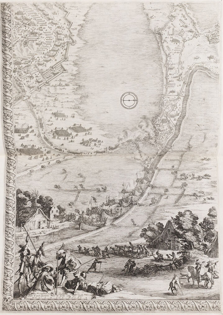
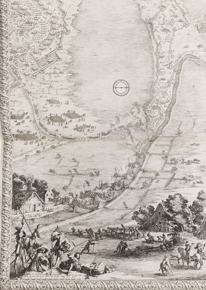
| Map | 87.3 | |
|
| ||
| Art | 75.6 | |
|
| ||
| Drawing | 66.7 | |
|
| ||
| Slope | 65.6 | |
|
| ||
| Illustration | 62.7 | |
|
| ||
| Paper product | 62.5 | |
|
| ||
| Paper | 59.9 | |
|
| ||
| Painting | 57.4 | |
|
| ||
| Font | 56.6 | |
|
| ||
| Artwork | 54.5 | |
|
| ||
| Circle | 54 | |
|
| ||
| Printmaking | 52.7 | |
|
| ||
| Visual arts | 51.1 | |
|
| ||
Microsoft
created on 2021-04-03
| text | 99 | |
|
| ||
| map | 97.2 | |
|
| ||
| drawing | 89.8 | |
|
| ||
| sketch | 77.2 | |
|
| ||
| illustration | 66.2 | |
|
| ||
Color Analysis
Feature analysis


Categories
Imagga
| paintings art | 78.7% | |
|
| ||
| text visuals | 13.8% | |
|
| ||
| streetview architecture | 3.9% | |
|
| ||
| nature landscape | 3.1% | |
|
| ||
Captions
Microsoft
created on 2021-04-03
| map | 99.6% | |
|
| ||