
Machine Generated Data
Tags
Color Analysis
Feature analysis
Amazon
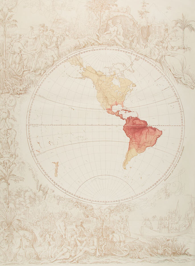
| Rug | 87.3% | |
Categories
Imagga
| paintings art | 99.9% | |
Captions
Microsoft
created on 2019-05-31
| a close up of a piece of paper | 74.4% | |
| close up of a piece of paper | 72.8% | |
| a piece of paper | 72.7% | |
OpenAI GPT
Created by gpt-4 on 2024-12-21
This is an image of an old map or chart, presented in a portrait orientation, featuring the Western Hemisphere, with a particular focus on South America and a portion of North America. The map is centered within a circle and the countries are colored in soft, muted tones, with South America prominently highlighted in pink and red tones. Surrounding the map are intricate line drawings with various themes. At the top left, there is a group of people in classical attire, possibly representing an allegorical scene or the Old World. To the right, at the top corner, there is a woman reclining near an anchor and seems to be gazing pensively, possibly symbolizing contemplation or navigation. At the bottom, more elaborate scenes are depicted. On the left, we see a collection of individuals in various states of rest, activity, and interaction, which could represent daily life or cultural aspects. On the right, there's an image of men with a boat; the scene could relate to exploration or trade. Overall, the map is edged with complex iconography and embellished with dramatic detail, symbolizing a blend of geographic exploration and the cultural or historical context related to the regions shown. The specifics of the imagery could refer to themes of discovery, colonization, or the meeting of different cultures.
Created by gpt-4o-2024-05-13 on 2024-12-21
The image depicts an illustrated map of the Americas, notable for its artistic and historical elements surrounding the geographical depiction. The map shows North, Central, and South America, with varying shades of yellow, red, and pink to possibly denote different territories or regions. Surrounding the map, there are intricate illustrations of indigenous people, European explorers, and various aspects of the natural environment. At the top center, a scene portrays two individuals within a natural setting, while other areas depict activities such as navigation and traditional practices of native communities. On the left and right sides of the map, flora and fauna are meticulously drawn, contributing to the artwork's detailed and decorative nature. The map and the illustrations together present a combination of cartographic detail and artistic storytelling, likely reflecting the historical encounters and natural history of the Americas.
Anthropic Claude
Created by claude-3-haiku-20240307 on 2024-12-21
The image appears to be an antique map of the world, with a central circular map depicting the landmasses of North and South America. The map is surrounded by intricate illustrations of figures, flora, and other decorative elements. The landmass of the Americas is shown in shades of red, indicating different regions or territories. The overall style and design suggest this is a historical or decorative cartographic work, rather than a modern geopolitical map.
Created by claude-3-5-sonnet-20241022 on 2024-12-21
This is a historical map showing the Western Hemisphere, specifically focusing on North and South America. The map is presented in a circular projection and is decorated with ornate illustrations around its borders in a sepia or light brown tone. South America appears highlighted in a reddish-orange color, while North America is shown in a lighter beige shade. The decorative border includes artistic vignettes that appear to depict colonial or exploration scenes, with various figures, palm trees, and ornamental designs. The artistic style suggests this is likely from the colonial period, possibly 18th or early 19th century. The geographical details include latitude and longitude lines, and the map shows remarkable detail for its time period, particularly along the coastlines of both continents. The Caribbean region is clearly visible between North and South America. The overall presentation combines both cartographic accuracy and artistic beauty, which was characteristic of important maps from this historical period.
Meta Llama
Created by us.meta.llama3-2-11b-instruct-v1:0 on 2024-12-21
The image is a map of the Americas, specifically the Western Hemisphere, with a focus on the continents of North and South America. The map is rendered in a sepia tone, with a circular design that features a grid pattern and lines radiating from the center. **Key Features:** * **Circular Design:** The map is circular in shape, with a diameter that spans the entire width of the image. The circular design is divided into sections by lines that radiate from the center, creating a sense of symmetry and balance. * **Grid Pattern:** A grid pattern is superimposed over the circular design, with horizontal and vertical lines that intersect at regular intervals. This grid pattern helps to create a sense of order and organization, making it easier to navigate the map. * **Lines Radiating from the Center:** Lines radiate from the center of the map, creating a sense of movement and energy. These lines are spaced at regular intervals and are evenly distributed around the circumference of the circle. * **Color Scheme:** The map is rendered in a sepia tone, which gives it a warm and nostalgic feel. The color scheme is muted, with shades of brown and beige dominating the palette. * **Map Details:** The map features a range of details, including the names of countries, cities, and geographical features such as mountains and rivers. The map also includes illustrations of people, animals, and plants, which add to its visual interest and charm. **Overall Impression:** The image is a beautiful and detailed map of the Americas, with a unique circular design and a muted color scheme. The grid pattern and lines radiating from the center create a sense of order and balance, while the illustrations add a touch of whimsy and personality to the map. Overall, the image is a stunning representation of the Western Hemisphere, with a focus on the continents of North and South America.
Created by us.meta.llama3-2-90b-instruct-v1:0 on 2024-12-21
This image presents a vintage-style map of the Americas, featuring a prominent globe at its center. The globe is rendered in a warm, sepia-toned color scheme, with the continents depicted in various shades of red and yellow. The surrounding area is adorned with intricate illustrations of people, plants, and animals, evoking a sense of adventure and exploration. The map appears to be a reproduction of an antique print, with the text "Tab. geograph. I" visible in the top-left corner. The overall aesthetic suggests a nostalgic and educational tone, inviting viewers to explore the rich history and geography of the Americas.
Amazon Nova
Created by amazon.nova-lite-v1:0 on 2025-02-24
This image is a vintage map of the Americas, possibly from the 18th century. The map is circular and features a detailed depiction of the continents of North and South America, along with the surrounding oceans. The map is adorned with intricate drawings of plants, animals, and people, adding a decorative touch to the geographical representation. The map is centered around the Americas, with North America occupying the upper portion and South America in the lower portion. The map's borders are marked by a delicate border design, and the continents are divided into various regions, each with its own distinct color and shading. The map's decorative elements include drawings of indigenous people, animals, and plants. These drawings are scattered throughout the map, adding a sense of life and movement to the otherwise static geographical representation. The people are depicted in various poses, some standing, some sitting, and some engaged in activities such as hunting or fishing. The animals depicted on the map include birds, mammals, and reptiles. Some of the animals are native to the Americas, while others may have been imported from other parts of the world. The plants depicted on the map include trees, flowers, and other vegetation, adding a touch of natural beauty to the overall design. Overall, the vintage map of the Americas is a beautiful and intricate representation of the continents, featuring detailed geographical information and decorative elements that add to its visual appeal. The map's age and style suggest that it may have been created during a time when maps were still hand-drawn and considered works of art.
Created by amazon.nova-pro-v1:0 on 2025-02-24
The image shows a map of the world, specifically the continents of North and South America. The map is surrounded by illustrations of people and nature. The people in the illustrations are wearing traditional clothing, and some are holding sticks. The map is divided into sections, with each section representing a different country or region. The map is drawn in a vintage style, with a brownish color and a slightly faded appearance.
Text analysis
Amazon


