
Machine Generated Data
Tags
Color Analysis
Feature analysis
Amazon
Clarifai
AWS Rekognition
| Blackboard | 95.1% | |

Categories
Imagga
created on 2023-10-07
| nature landscape | 92.7% | |
| streetview architecture | 2.6% | |
| text visuals | 2.2% | |
Captions
Microsoft
created by unknown on 2018-05-10
| a vintage photo of a blackboard | 54.2% | |
| a blackboard near a window | 49.8% | |
| an old photo of a blackboard | 49.7% | |
Clarifai
No captions written
Salesforce
Created by general-english-image-caption-blip on 2025-05-03
a photograph of a map of a city with a map of the area
Created by general-english-image-caption-blip-2 on 2025-07-07
a black and white photo of a map with many small dots
OpenAI GPT
Created by gpt-4o-2024-11-20 on 2025-06-09
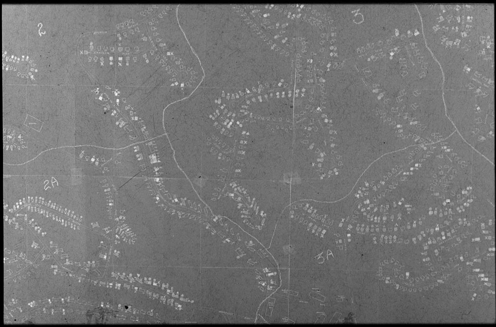
This image shows a black-and-white representation of a detailed, hand-drawn map or diagram that appears to depict a settlement or village layout. The drawing includes clusters of small geometric shapes, such as rectangles and squares, which likely represent buildings or structures. These clusters are arranged in an irregular pattern across the map, potentially following the natural contours of the terrain, as suggested by curved lines resembling roads or pathways. The map includes labels such as "2A" and "3A," which seem to organize sections or areas within the layout.
The overall impression indicates this could be an aerial view or cartographic depiction of a densely populated area, meticulously rendered. The faint lines and grid marks suggest an attempt to structure the space for analytical or planning purposes.
Created by gpt-4o-2024-08-06 on 2025-06-09
The image appears to be a grayscale photograph of a map or a diagram. The background is a continuous gray, on which numerous small symbols are arranged in what looks like a planned structure or layout. The symbols are mainly small squares, rectangles, and other irregular shapes, appearing to represent plots or structures, possibly depicting a settlement or topographical plan. There are also some winding lines that could represent roads, paths, or natural boundaries such as rivers. Handwritten annotations or labels are visible, which include alphanumeric characters such as "2A" and "3A." The entire image gives the impression of a hand-drawn map, possibly an architectural or landscape sketch. The bottom of the image has a copyright notice from Harvard University Art Museums.
Anthropic Claude
Created by anthropic.claude-3-haiku-20240307-v1:0 on 2025-06-13
This image appears to be an aerial photograph or satellite image of a rural or semi-rural area. The image shows a landscape with scattered clusters of buildings and roads, suggesting a sparsely populated region. The overall image has a grayscale, monochrome appearance, which is typical of older aerial or satellite imagery. There are no identifiable human figures or faces visible in this image.
Created by us.anthropic.claude-3-5-sonnet-20241022-v2:0 on 2025-06-13
This appears to be an aerial or satellite photograph, shown in black and white. It shows what looks like a suburban or residential area from above, with clusters of buildings or houses appearing as small white dots scattered across the darker landscape. There are winding roads or paths visible as light lines connecting these clusters. The image has a grainy, documentary quality typical of aerial surveillance or mapping photography. The pattern of development shown suggests this may be from a mid-20th century suburban area, with houses spaced out along curving streets rather than arranged in a strict grid pattern.
Meta Llama
Created by us.meta.llama3-2-11b-instruct-v1:0 on 2025-05-28
The image presents a black-and-white photograph of a map, likely created in the early 20th century, featuring a grid pattern with white lines and various symbols. The map appears to be hand-drawn on a light gray or beige surface, possibly paper or cardboard.
Map Details:
- Grid Pattern: The map features a grid pattern, which is commonly used for mapping purposes. The grid is composed of intersecting lines that create squares or rectangles, helping to organize and label geographical features.
- White Lines: White lines are drawn across the map, likely indicating roads, trails, or other pathways. These lines may also represent boundaries between different areas or regions.
- Symbols: Various symbols are scattered throughout the map, including letters, numbers, and geometric shapes. These symbols could represent different types of land use, such as buildings, forests, or bodies of water. They may also indicate specific locations or points of interest.
- Scale: The scale of the map is not explicitly indicated, but it appears to be a small-scale map, possibly covering a large area. The level of detail suggests that it may be a regional or national map rather than a local or city-scale map.
Context:
- Copyright Information: A copyright notice at the bottom of the image reads "© President and Fellows of Harvard College (Harvard University Art Museums)." This indicates that the map is part of the Harvard University Art Museums' collection and is protected by copyright.
- Date: Although the exact date of the map is not specified, the style and content suggest that it was created in the early 20th century, likely between 1900 and 1950.
Conclusion:
The image presents a detailed and informative map that provides valuable insights into the geography and layout of a particular region. The use of a grid pattern, white lines, and symbols allows for easy navigation and identification of different features. The copyright information and date suggest that the map is a historical artifact, offering a unique window into the past.
Created by us.meta.llama3-2-90b-instruct-v1:0 on 2025-05-28
The image is a grayscale map with white lines and symbols, featuring a grid pattern with numbers and letters. The map appears to be a topographic or cadastral map, showing the layout of land parcels and boundaries.
Key Features:
- Grid pattern with numbers and letters
- White lines and symbols indicating boundaries and features
- Numbers and letters in the corners, possibly indicating coordinates or reference points
- A copyright notice at the bottom left corner, indicating that the image is owned by the President and Fellows of Harvard College (Harvard University Art Museums)
Possible Purpose:
- The map may have been used for planning, surveying, or administrative purposes.
- It could be a historical map, showing the layout of a particular area at a specific point in time.
Overall Impression:
- The image suggests a detailed and precise representation of the area, with careful attention to scale and accuracy.
- The use of a grid pattern and symbols indicates a high level of organization and planning.
Amazon Nova
Created by amazon.nova-lite-v1:0 on 2025-06-04
The image appears to be a grayscale aerial photograph of a city or town. The photograph shows a grid-like pattern of streets and buildings, with various symbols and annotations overlaid on the image. The image is labeled with the copyright information "© President and Fellows of Harvard College (Harvard University Art Museums)" and the accession number "P1970.4287.0001." The photograph appears to be a historical image, possibly from the mid-20th century, based on the style of the buildings and the lack of modern infrastructure.
Created by amazon.nova-pro-v1:0 on 2025-06-04
The image is a grayscale photograph of a map, which appears to be an aerial view of a city or urban area. The map is divided into sections, each labeled with a letter and number combination, such as "2A" and "5A." The map shows a network of roads and streets, with buildings and other structures visible in the background. The buildings are mostly rectangular and appear to be of varying sizes and styles. The map also includes some text and labels, but they are difficult to read due to the low resolution of the image.
Google Gemini
Created by gemini-2.0-flash-lite on 2025-05-01
This is a black and white aerial view, likely a photograph or a scanned document, of a suburban area. The image appears to be an older document due to its graininess and the visible imperfections, such as dust specks, scratches, and the grid-like structure of the image.
Here's a breakdown:
- Layout: The image is filled with the outlines of buildings, presumably houses, arranged in a planned layout with winding streets. Some buildings are marked with symbols, like Xs or squares, which may indicate different types of structures or points of interest.
- Markings: Handwritten labels like "2", "2A", "3", and "3A" are visible, probably denoting sections or zones within the larger area.
- Scale and Perspective: Given the aerial view, the image gives a bird's-eye perspective, enabling the visualization of the wider geographical distribution of buildings and the layout of the surrounding areas.
- Overall Impression: The image has an official, perhaps archival, quality about it. It serves as a historical document of urban planning and development.
Created by gemini-2.0-flash on 2025-05-01
Here is a description of the image:
The image is a black and white aerial map of a residential area, likely from the mid-20th century. It appears to be a photographic print with some imperfections such as scratches and specks. The map shows streets, houses, and possibly other buildings. The houses are represented as small shapes, and some of them have X's drawn over them. The streets are shown as white lines, winding through the residential areas. There are numbered sections on the map, marked as "2", "2A", "3", and "3A". The image is copyrighted by "President and Fellows of Harvard College (Harvard University Art Museums)". The print number is "P1970.4287.0001".
Mistral Pixtral
Created by us.mistral.pixtral-large-2502-v1:0 on 2025-06-03
The image appears to be an aerial photograph of a rural area, likely taken from a significant height, possibly from an airplane or satellite. The photograph is in black and white, which suggests it might be of historical significance or taken before color photography became widespread.
Key features of the image include:
Roads and Pathways: There are several visible roads and pathways crisscrossing the landscape. These roads are relatively thin and winding, indicating that they might be rural or less developed.
Buildings and Structures: Scattered throughout the image are numerous small, white, rectangular shapes. These are likely buildings or houses, suggesting a dispersed settlement pattern typical of rural areas.
Fields and Open Spaces: Large areas of the image are relatively empty, indicating fields or open spaces. These areas are likely used for agriculture or are undeveloped land.
Vegetation: There are some darker patches that could indicate forests or dense vegetation. These areas are less common compared to the open fields.
Water Bodies: There are no significant water bodies visible in the image, suggesting that the area might be inland or away from major rivers or lakes.
Grid Pattern: The layout of the buildings and roads suggests a grid-like pattern in some areas, which is a common planning technique in rural and suburban developments.
Overall, the image provides a detailed view of a rural landscape with scattered settlements, roads, and open fields, likely used for agricultural purposes.
Qwen
Created by Qwen/Qwen2.5-VL-7B-Instruct on 2025-07-11
The image appears to be a grayscale aerial photograph or map, showing an area with a dense distribution of what look like small buildings or structures. The structures are marked with various symbols or labels, possibly indicating different types or uses. The area is divided into sections, some of which are labeled with numbers such as "2," "2A," and "3A." There are also some curved lines that could represent roads or boundaries. The overall appearance suggests this might be a detailed map or a topographical survey of a specific area.
Created by Qwen/Qwen2.5-VL-72B-Instruct on 2025-07-11
This image appears to be an aerial photograph or a map of a settlement, likely from a historical or archaeological context. The photograph shows a pattern of small structures or dwellings, possibly representing a village or a small town. The structures are arranged in clusters and along pathways or roads that curve and intersect.
The image has a grid overlay with numbers and letters, suggesting it might be part of a larger mapping or survey project. The numbers and letters could be used for referencing specific sections of the map. The overall texture and quality of the image suggest it might be an old photograph or a reproduction of an old photograph. The image is in black and white, which is typical for historical aerial photography.
The image is credited to the President and Fellows of Harvard College (Harvard University Art Museums), indicating it might be part of a collection or study related to historical or archaeological research.
Text analysis
Amazon


