Machine Generated Data
Tags
Color Analysis
Face analysis
Amazon

AWS Rekognition
| Age | 20-32 |
| Gender | Male, 96.2% |
| Angry | 71.2% |
| Calm | 25.3% |
| Sad | 1.3% |
| Fear | 1.2% |
| Surprised | 0.5% |
| Disgusted | 0.3% |
| Happy | 0.2% |
| Confused | 0.1% |
Feature analysis
Amazon

| Book | 100% | |
Categories
Imagga
| paintings art | 99.5% | |
Captions
Microsoft
created on 2021-04-03
| a close up of a piece of paper | 76.3% | |
| a piece of paper | 76.2% | |
| close up of a piece of paper | 73.4% | |
OpenAI GPT
Created by gpt-4o-2024-05-13 on 2025-02-12
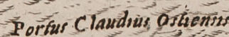
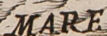
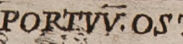
The image shows a highly detailed illustration of a historical harbor, identified as "Portus Ostiensis" or the Port of Ostia, associated with Emperor Trajan (Traianus). The layout is meticulously drawn, showcasing various structures including buildings, walls, and waterways. At the top of the illustration, the inscriptions "CLAVDI ET TRAIAN IMP ADMIRABI VA PORTVS OSTIENS CIOGR" can be seen, indicating the connection to Emperors Claudius and Trajan. The drawing includes a series of buildings arranged around a central octagonal basin, which likely represents a significant dock or central feature of the port. Ships are depicted both within the harbor and outside in the sea labeled "MARE TYRRHENUM" (Tyrrhenian Sea). There is also a prominent entrance feature labeled "Porta Clauda Orientis," which appears to be a significant gateway or part of the entrance to the harbor. Additionally, a large statue or figure is situated prominently at the harbor’s entrance, and a detailed compass rose indicating orientation is located in the upper right portion. The text at the bottom of the page likely provides a historical context or description of the port and its construction. The overall appearance suggests it comes from a historical or architectural text, potentially a book on ancient Roman engineering or city planning.
Created by gpt-4 on 2025-02-12
The image shows a detailed black and white illustration or engraving of an ancient city plan or map, possibly Roman due to the architecture and text style. The map is part of an open book with text on both the left page and below the map itself on the right page, indicating it could be from a historical or archaeological work. In the illustration, the city or area is laid out with a series of buildings that have a classical architectural design. There are walls, roads, what appear to be fortifications, and various urban structures. The perspective is an aerial, bird's-eye view, which was typical for maps of this kind during the era they were produced. On the right side of the map, there's a body of water labeled "MARE TYRRHENUM", which is the Tyrrhenian Sea, part of the Mediterranean Sea. There are also ships in the water, emphasizing the maritime activities of the area. On the water, near the top right corner, there is a compass rose, providing orientation with the cardinal directions. At the bottom of the illustration, there is a lengthy paragraph in Latin which likely describes the historical context or details of the map. The top of the map contains a title written in Latin, mentioning specific historical names or locations, suggesting the depicted city might be important historically, possibly linked to the period of the Roman Empire. The open book and the illustration both have an antiquated look, suggesting that the book itself is quite old or is designed to replicate the appearance of an ancient text.
Anthropic Claude
Created by claude-3-5-sonnet-20241022 on 2025-02-12
This is a historical map/illustration showing the Port of Ostia (Portus Claudius Ostiensis), the ancient Roman port city at the mouth of the Tiber River. The image appears to be from an old book or manuscript, with Latin text at the top identifying it as being from the time of Emperor Claudius and Trajan. The illustration shows an aerial/bird's eye view of the port complex, including: - The hexagonal harbor basin - Various warehouses and buildings - City walls and fortifications - Ships in the harbor - A lighthouse or beacon tower - The Tyrrhenian Sea (Mare Tyrrhenum) - The Tiber River (Flumen Tiberis) The drawing includes a compass rose in the upper right corner and has detailed architectural features throughout. Below the illustration is a block of Latin text explaining details about the port's construction and history. This is an important historical document as it shows one of ancient Rome's most crucial maritime facilities, through which much of the city's grain and other essential supplies were imported. The port was initially built under Emperor Claudius and later improved by Trajan, serving as Rome's principal seaport in antiquity.
Created by claude-3-opus-20240229 on 2025-02-12
The image depicts an old map or illustration of a coastal town or port city, likely from the 16th or 17th century based on the artistic style. The town is shown in great detail, with many buildings, fortifications, docks, and ships visible. At the center is what appears to be the main plaza or square, surrounded by prominent structures that could be administrative buildings, churches, or defensive towers. Radiating out from this central area are streets lined with dense clusters of smaller buildings, likely representing residential areas. The port facilities are extensive, with multiple wharfs, jetties and docks jutting out into the water. Several ships of different sizes are shown moored in the harbor or approaching the port. In the water, a large compass rose indicates the map's orientation. Encircling the settled area are walls and bastions, suggesting this was a well-fortified town. Zooming in, even minute details like individual windows and architectural elements on buildings can be discerned. The text below the illustration, though hard to read, seems to provide a description or history of the portrayed location. Overall, it's an intricately detailed and fascinating glimpse into the layout and appearance of a historic Mediterranean or Adriatic port town.
Created by claude-3-haiku-20240307 on 2025-02-12
The image appears to be an engraved map or illustration depicting a coastal city, likely Rome or a similar historic Mediterranean city. The image shows a detailed view of the city, with numerous buildings, structures, and landmarks visible. There are also ships and boats in the harbor area. The illustration has a classical, ornate style typical of historical maps and engravings. The text surrounding the image appears to be in Latin, further suggesting this is a historical rendering of an important city or location.
Meta Llama
Created by us.meta.llama3-2-11b-instruct-v1:0 on 2025-03-18
The image presents a detailed, black-and-white illustration of a fortified city situated on a hillside, surrounded by water and featuring a harbor. The city is depicted with numerous buildings, including fortifications, towers, and a church. * **Cityscape:** * The city is situated on a hillside, with buildings arranged in a seemingly haphazard manner. * The city's architecture appears to be a mix of medieval and Renaissance styles. * The city is surrounded by a wall or fortification, with towers at regular intervals. * A church is visible in the center of the city, with a tall steeple rising above the surrounding buildings. * **Waterfront:** * The city is situated on the waterfront, with a harbor visible in the foreground. * Several ships are depicted in the harbor, including a large sailing vessel and several smaller boats. * The waterfront is lined with buildings, including warehouses and other structures. * **Surroundings:** * The city is surrounded by water, with a small island visible in the background. * The surrounding landscape is depicted as rocky and barren, with no signs of vegetation. * The sky above is cloudy and overcast, adding to the sense of gloom and foreboding. In summary, the image presents a detailed and atmospheric illustration of a fortified city situated on a hillside, surrounded by water and featuring a harbor. The city's architecture is a mix of medieval and Renaissance styles, and the surrounding landscape is depicted as rocky and barren. The image conveys a sense of history and grandeur, while also hinting at the dangers and uncertainties of life in a fortified city.
Created by us.meta.llama3-2-90b-instruct-v1:0 on 2025-03-18
The image depicts a vintage book with yellowed pages, featuring an illustration of a city or town on one page. The illustration is rendered in black and white, showcasing various buildings, structures, and waterways. The text surrounding the illustration appears to be written in Latin, although it is not legible due to its small size and faded quality. The book's cover is not visible, but the pages are worn and torn, suggesting that the book is old and has been handled extensively. The overall atmosphere of the image evokes a sense of nostalgia and historical significance, as if the book contains valuable information or stories from the past.
Amazon Nova
Created by amazon.nova-pro-v1:0 on 2025-02-12
The image shows an old book with a map of a city on the right side. The book is open, and the page has some text written on it. The map is in black and white, and it shows the city with its buildings, roads, and waterways. The city is surrounded by a wall, and there are some trees and a mountain in the distance. The map is titled "Clavdelet Fraiani Imp. Admirabi."
Created by amazon.nova-lite-v1:0 on 2025-02-12
An old book with a black-and-white map is open. The map is of a city with buildings, a port, and a tower. The text "Clavde et Trajani Imp. Admirabi." is written on the top left of the map. The map also has a compass rose on the right side. The book is old and has a worn-out cover. The book is placed on a white surface.
Text analysis
Amazon