Machine Generated Data
Tags
Color Analysis
Categories
Imagga
| interior objects | 83.3% | |
| text visuals | 13.3% | |
| streetview architecture | 2.9% | |
Captions
Microsoft
created on 2022-06-04
| an old photo of a computer screen | 40.8% | |
| graffiti on a wall | 40.7% | |
| a screen shot of a computer | 40.6% | |
Azure OpenAI
Created by gpt-4 on 2024-12-07
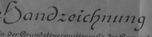
This image shows an old, framed document, which appears to be a map or blueprint, based on the lines and annotations visible on the surface. The document is mostly grayscale, possibly due to the photograph itself being black and white, or the document may inherently be monochromatic. The map features various labeled plots, roads or pathways, and topographical details, and it includes a compass rose indicating the north direction. There is text and numbers that seem to provide details about the mapped area, likely indicating property boundaries or land divisions. Some of the text is in German, as seen with words like "Handzeichnung" which translates to "hand drawing." Although parts of the document are torn and deteriorated with age, official stamps and signatures are visible on the bottom left, which suggest that it was an official document at one point. The top right corner reads "Massstab 1:2000," indicating the scale of the map as 1:2000. Lastly, there is an identification number "48.19" at the bottom right-hand corner, which may correspond to a catalog or archive reference number. The document is behind a protective cover, which shows signs of aging or moisture damage, and is affixed within a frame that has some frothed foam at the borders—suggesting protective or archival padding placed around the document for preservation.
Created by gpt-4o-2024-05-13 on 2024-12-07
This image is of a framed, black and white historical map or land survey document. The text, symbols, and design elements suggest it belongs to a German-speaking region, as indicated by the German words "Handzeichnung" (hand drawing) and "Maßstab" (scale) that are visible. It includes various geographical details, lines for boundaries, areas labeled with numbers or names, and a compass rose showing the cardinal directions. Official seals and signatures are also present at the bottom of the document, indicating authenticity and authority. The map is labeled with a scale of 1:2000. The document seems to be quite old, as the paper appears folded and worn, indicating age. There is also a label with the number "48.19" at the bottom right corner of the frame.
Anthropic Claude
Created by claude-3-haiku-20240307 on 2024-12-07
The image appears to be a black and white photographic reproduction of a map or land survey document. The document is titled "Grenzzeichnung" which translates to "Border Demarcation" in English. The map shows a detailed topographical layout with various land parcels, roads, and other geographic features. There are no human faces or identifiable individuals visible in the image.
Created by claude-3-5-sonnet-20241022 on 2024-12-07
This appears to be a historical German land or property map (Handzeichnung). It's a black and white surveyor's drawing that shows property boundaries, roads, and land parcels. The map includes a compass rose indicating north and appears to be drawn to a scale of 1:8000 as noted in the title. There are various numbered plots and sections marked throughout the map, with text labels in German. Official stamps or seals are visible in the lower left portion of the document. The map seems to date from the early to mid-20th century based on its style and presentation. The detail and precision suggest it was likely used for official property or administrative purposes.
Meta Llama
Created by us.meta.llama3-2-11b-instruct-v1:0 on 2024-12-07
The image depicts a black-and-white map, likely from the early 20th century, featuring a mix of handwritten and printed text in German. The map is divided into sections, with some areas labeled and others left blank. A compass rose is visible in the top-left corner, indicating the orientation of the map. The map appears to be a property survey or land division, with various symbols and markings throughout. Some areas are shaded or highlighted, suggesting different land uses or ownership. The text on the map includes place names, property boundaries, and possibly legal descriptions or ownership information. The map is mounted on a white background, surrounded by a thick black border. A small label in the bottom-right corner reads "48.19," which may indicate the map's reference number or cataloging information. Overall, the image provides a glimpse into the historical mapping practices and land use patterns of the region depicted. The map's age and condition suggest that it may be a rare or valuable document for researchers or historians studying the area's development and evolution over time.
Created by us.meta.llama3-2-90b-instruct-v1:0 on 2024-12-07
The image appears to be a black-and-white map or document, possibly a historical or archival item. The map is folded and creased, with some tears and damage visible along the edges. It features handwritten text in German, including what appears to be a title or heading at the top, as well as various labels and annotations throughout. The map itself depicts a rural area with roads, fields, and other geographical features. There are several symbols and markings on the map, including what looks like a compass rose in the top-left corner. The overall appearance of the map suggests that it may have been created in the late 19th or early 20th century. In the bottom-right corner of the image, there is a small white label with the number "48.19" written on it. This could potentially be a cataloging or inventory number for the map, indicating that it is part of a larger collection or archive. Overall, the image presents a fascinating glimpse into the past, offering insights into the geography, culture, and history of the region depicted on the map.
Text analysis
Amazon