Machine Generated Data
Tags
Color Analysis
Feature analysis
Amazon
Clarifai

Clarifai
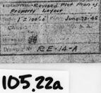
| Picture frame | 99.7% | |


Categories
Imagga
created on 2022-06-04
| text visuals | 85.4% | |
| paintings art | 13.9% | |
Captions
Microsoft
created by unknown on 2022-06-04
| a screen shot of a window | 55.1% | |
| a screen shot of a computer | 50.5% | |
| a screen shot of a computer monitor | 30.5% | |
Clarifai
No captions written
Salesforce
Created by general-english-image-caption-blip-2 on 2025-07-02
a black and white drawing of a building plan
Created by general-english-image-caption-blip on 2025-05-03
a photograph of a drawing of a drawing of a plan for a house
OpenAI GPT
Created by gpt-4 on 2024-12-07
You are looking at a framed black and white image of an architectural drawing or a plan. The drawing appears to be on aged paper and includes several shapes and lines, indicative of a site layout or a structural design. It features various annotations and measurements which are common in engineering or architectural blueprints. On the right side of the paper, there is a label containing some text, perhaps describing the contents or providing reference information about the plan, such as a date or a drawing number ("R.E.V./A"). At the bottom right corner of the frame, there is an additional label or tag with the code "105.22a" which might be an inventory or archive reference number. The drawing is contained in a frame with a simple black border, and the frame itself has a white mat background, which gives a clean border around the drawing.
Created by gpt-4o-2024-05-13 on 2024-12-07
The image depicts a technical drawing, likely an engineering or architectural plan. It is framed and appears to be held open by two cylindrical objects placed at the left and right edges. The drawing includes various lines, measurements, and annotations, which might denote dimensions and design specifications. In the bottom right corner, there is a specific section containing additional details and possibly a title or legend. There is also a label in the bottom right corner outside the frame marked "105.22a." The entire presentation suggests it is a detailed and precise document likely related to some form of infrastructure or industrial facility.
Anthropic Claude
Created by us.anthropic.claude-3-5-sonnet-20241022-v2:0 on 2025-06-25
This image appears to be an architectural or engineering drawing, likely a site plan or track layout diagram. It's a black and white technical drawing that shows what seems to be railway or transit lines with various intersections and branches. The drawing has a reference number "RE-14-A" visible in the corner, and there appears to be "105.22a" marked on it as well. The document appears to be mounted or framed with white margins and a dark border. The drawing style suggests it could be a vintage or historical document, possibly a blueprint or similar technical document used for planning or documentation purposes.
Created by claude-3-haiku-20240307 on 2024-12-07
The image appears to be a black and white blueprint or engineering schematic. It contains various lines, shapes, and labels indicating a technical drawing or plan. The image is framed within a black border and has the number "105.22a" written at the bottom of the frame.
Created by claude-3-5-sonnet-20241022 on 2024-12-07
This image appears to be an old architectural or site plan drawing, shown in black and white. The drawing shows what looks like a layout or plot plan with curved pathways or roads on either side, and some sort of structure or building complex in the center. The drawing has a technical, blueprint-like quality and includes various lines, both solid and dotted, indicating different features of the site. It appears to be mounted or framed, with what looks like reference number "105.22a" visible at the bottom. The drawing style and format suggests this is likely a historical planning or construction document.
Meta Llama
Created by us.meta.llama3-2-11b-instruct-v1:0 on 2024-12-07
The image presents a black-and-white photograph of a hand-drawn map or blueprint, showcasing a detailed layout of a property or area. The map is rendered in pencil and features various lines, symbols, and notations that suggest it is a technical drawing or architectural plan.
Key Features:
- Map or Blueprint: The central focus of the image is a hand-drawn map or blueprint, likely created for a specific purpose such as architectural design, urban planning, or surveying.
- Pencil Drawing: The map is drawn in pencil, indicating that it may be a preliminary or draft version of the design.
- Technical Drawing: The presence of various lines, symbols, and notations suggests that the map is a technical drawing, possibly used for construction or engineering purposes.
- Architectural Plan: The map's layout and details imply that it may be an architectural plan, outlining the design and features of a building or structure.
- Urban Planning: The map could also be related to urban planning, showing the layout of a city block, neighborhood, or other urban area.
- Surveying: Alternatively, the map might be a surveying document, detailing the boundaries and features of a property or land parcel.
- Hand-Drawn: The map is hand-drawn, which suggests that it was created by an individual or small team rather than a computer-aided design (CAD) software.
- Black-and-White: The image is presented in black-and-white, which may indicate that the original map was not colored or that the photographer chose to capture it in monochrome.
Overall Impression:
The image conveys a sense of precision and attention to detail, suggesting that the map is a carefully crafted document intended for a specific purpose. The use of pencil and the presence of technical drawings and notations imply that the map is a serious and professional document, possibly used for official or legal purposes.
Created by us.meta.llama3-2-90b-instruct-v1:0 on 2024-12-07
The image depicts a black-and-white map or blueprint, likely of a property or land area. The map is rectangular in shape and features a central section with various lines, symbols, and markings that appear to represent different features such as roads, buildings, and boundaries. The map also includes some handwritten notes and labels, which may provide additional information about the location or purpose of the map.
The map is surrounded by a thick black border, which helps to frame the image and create a sense of depth. The background of the image is a light gray color, which provides a neutral contrast to the darker tones of the map.
Overall, the image suggests that it is a historical or archival document, possibly related to urban planning, architecture, or geography. The level of detail and the use of technical symbols and markings suggest that the map was created for a specific purpose, such as planning or surveying.
Amazon Nova
Created by amazon.nova-lite-v1:0 on 2025-02-28
The image appears to be a technical drawing or blueprint of a building layout. It shows a floor plan with various rooms, corridors, and structural elements. The drawing is placed within a black frame, and there are two metal rods on either side of the frame, likely for mounting purposes.
The drawing itself is a black-and-white sketch, with lines and annotations indicating different features of the building. There are labels and numbers scattered throughout the drawing, likely indicating room numbers, dimensions, or other relevant information.
The drawing is labeled with the number "105.22a" at the bottom, possibly indicating the specific section or page number within a larger set of plans. There is also a date mentioned, "June 28, 1996," which could be the date when this particular drawing was created or revised.
Overall, the image appears to be a technical drawing used for planning or construction purposes, providing a detailed layout of a building's interior spaces and structural elements.
Created by amazon.nova-pro-v1:0 on 2025-02-28
The image shows a drawing of a building plan on a piece of paper with a black border. The drawing is placed on a white background, and there are two pieces of metal on the left and right sides of the paper. The drawing has a grid-like structure, with lines and numbers indicating the dimensions and layout of the building. There is also a label with the text "105.22a" in the bottom right corner of the image.
Google Gemini
Created by gemini-2.0-flash on 2025-05-18
Here's a description of the image:
The image shows a framed document, likely a blueprint or technical drawing, held in place by metal strips on either side. The drawing appears to be a "Revised Plot Plan of Property Layout" dated June 23, 1945. The scale is noted as 1:100' (inches).
The drawing itself depicts a site plan, possibly for an industrial or commercial property. There are roads, buildings, and other site features indicated with lines and labels. The document is labeled as "RE-14-A."
A small white label with the number "105.22a" is affixed to the white frame in the lower center of the image. The frame is a dark color, likely black.
Created by gemini-2.0-flash-lite on 2025-05-18
Here's a description of the image:
Overall Impression:
The image is a black and white photograph of a framed architectural or engineering drawing. The drawing itself appears to be a plot plan or layout of a property.
Details:
- The Drawing: The main subject is a rectangular drawing on a piece of aged, slightly crumpled paper. The drawing features lines, symbols, and possibly text or labels that depict a property layout. It seems to show roads or pathways and a central structure. The level of detail suggests a blueprint or technical drawing.
- Framing and Mounting: The drawing is mounted on a white surface, likely within a black frame. Two rectangular clips are used to secure the drawing to the mount.
- Label: Below the drawing, a white label with the text "105.22a" is present.
- Text: A title appears in the bottom right corner, indicating that the drawing is titled "Revised Plot Plan of Property Layout". It also includes the date of June 23-45 and a scale of 1:100 ft. The Drawing code is "RE-14-A".
- Quality: The photograph is well-lit and clear, preserving the detail of the original drawing and its framing.
Overall, the image is a photographic record of a historical architectural or engineering plan, presented in a simple and professional manner.
Mistral Pixtral
Created by us.mistral.pixtral-large-2502-v1:0 on 2025-06-06
The image shows a framed architectural blueprint or technical drawing. The blueprint appears to be an overhead or plan view layout, possibly of a building or a specific room within a building. Key features and details include:
Layout and Dimensions: The drawing includes various lines, curves, and measurements, indicating walls, partitions, and other structural elements. Dimensions are marked, providing specific lengths and distances between different parts of the layout.
Annotations and Labels: There are several annotations and labels throughout the blueprint. These likely describe different areas, components, or instructions related to the design. For example, there are labels such as "M" and "N" pointing to specific sections.
Date and Identification: The blueprint is dated "June 30, 1966," and includes a scale, indicating the ratio of the drawing to actual size (1/8" = 1'-0"). There is also a reference number or identifier "105.22a" written on a piece of paper at the bottom center of the frame.
Framing: The blueprint is mounted in a frame with a black border, and there are two vertical metal bars on either side of the frame, possibly to hold the blueprint in place or to weigh it down.
Purpose: The blueprint seems to be a detailed plan for construction or renovation, likely used by architects, engineers, or builders to ensure accurate implementation of the design.
Overall, the image captures a historical technical drawing that provides a detailed layout and measurements for a construction project from 1966.
Qwen
Created by Qwen/Qwen2.5-VL-7B-Instruct on 2025-07-27
The image is a black and white photograph of a framed architectural drawing or blueprint. The drawing appears to depict a layout plan for a property, showing various structures and their arrangement within the land. There are lines indicating the boundaries of the property and the layout of the buildings or sections of the layout. The blueprint includes annotations and measurements, suggesting it is a detailed plan for construction or design purposes. In the bottom right corner of the blueprint, there is a handwritten note and a reference number "105.22a". The overall style and appearance of the blueprint suggest it is from an earlier time period, likely the mid-20th century, given the handwriting and format.
Created by Qwen/Qwen2.5-VL-72B-Instruct on 2025-07-27
This image is a black-and-white photograph of a rolled-up architectural or engineering drawing. The drawing appears to be a site plan or layout for a property, as indicated by the label in the bottom right corner that reads "PROPERTY LAYOUT." The scale of the drawing is noted as "1:200" and it is dated "June 23–66." The drawing is labeled with the code "RE-14-A" and has a reference number "105.22a" in the bottom right corner, likely for cataloging or identification purposes.
The plan includes various lines and shapes that represent buildings, pathways, and possibly utility lines or other infrastructure elements. The drawing is mounted on a black frame with a white mat, and the roll is held in place by two metal spindles on either side. The overall presentation suggests that this is a preserved document, possibly for archival or display purposes.
Text analysis
Amazon