Machine Generated Data
Tags
Color Analysis
Feature analysis
Amazon
Clarifai

AWS Rekognition
| Monitor | 60.3% | |

Categories
Imagga
created on 2022-06-04
| text visuals | 74.4% | |
| interior objects | 22.5% | |
| paintings art | 2.4% | |
Captions
Clarifai
No captions written
Salesforce
Created by general-english-image-caption-blip on 2025-05-21
a photograph of a map of a map of a city
Created by general-english-image-caption-blip-2 on 2025-07-02
a black and white drawing of a river and a road
OpenAI GPT
Created by gpt-4 on 2024-12-07
The image shows a framed document or map, presented on a white background with a black frame. The document itself features what appears to be a technical drawing or architectural plan with various lines, annotations, and labels. These markings suggest the document might be a plan for a canal or some form of infrastructure. There's a title in the bottom right corner of the document which reads "Sault Sainte Marie Canal", indicating that this is likely a historical or planning document related to the Sault Ste. Marie Canal, perhaps detailing a specific section or aspect of its construction or design.
The document is somewhat worn and aged, with crease marks and some discoloration, suggesting it is an older document. There are hand-written notes, lines indicating structures or boundaries, and some topographical elements that are detailed on the map. There's a visible alphanumeric code "100.5b" near the bottom right of the frame, which could serve as an identifying reference for the document. The presentation and style indicate that this might be an archival piece or an exhibit item, possibly displayed for educational or historical purposes.
Created by gpt-4o-2024-05-13 on 2024-12-07
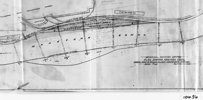
This image features an old, black and white schematic or engineering drawing of the Manayunk Canal. The drawing showcases a plan view with various labeled elements, such as roads, the canal itself, and other notable points of interest. Some labels present on the schematic include “Schuylkill Navigation Company” and “Plan Showing Manayunk Canal Divided Between Lock & Lock”. The image is framed, suggesting it might be of historical significance, likely preserved within protective glass to maintain its condition. The drawing appears worn and has some creases, indicative of its age. There is also a number written in the lower right corner, "100.56".
Anthropic Claude
Created by us.anthropic.claude-3-5-sonnet-20241022-v2:0 on 2025-06-25
This image appears to be an architectural or engineering drawing/plan showing what looks like a canal or waterway system. It's a black and white technical drawing that shows various curved lines and paths, possibly indicating water flow or navigation channels. The drawing has a title block at the bottom and appears to be professionally drafted. The document is shown mounted or framed against a dark border, and the overall image quality suggests it might be a historical or archival document. The drawing shows what appears to be the "Minafon Canal" based on text visible in the image, with various technical details and layout specifications shown in plan view.
Created by claude-3-haiku-20240307 on 2024-12-07
The image appears to be a black and white technical drawing or map. It shows a detailed layout of some kind of infrastructure or transportation system, with various labeled elements such as "Manitowoc", "Sheboygan Canal", and "Milwaukee". The drawing appears to be an old or vintage document, as evidenced by its faded and worn appearance. There are no human faces or identifiable individuals visible in the image.
Created by claude-3-5-sonnet-20241022 on 2024-12-07
This image appears to be a black and white engineering or architectural drawing showing a plan view of what appears to be the Minefunk Canal. The drawing is presented in a frame and shows the layout of the canal with various markings and lines indicating its course and features. The drawing appears to be technical in nature, likely used for planning or documentation purposes. The image has a reference number "1010.56" visible at the bottom. The drawing style is characteristic of engineering blueprints or technical drawings from an earlier era, with clean lines and annotations marking different sections or features of the canal system.
Meta Llama
Created by us.meta.llama3-2-11b-instruct-v1:0 on 2024-12-07
The image depicts a black and white photograph of a hand-drawn map or diagram, likely created for planning purposes.
The map is oriented horizontally, with its top edge aligned with the top of the image. It features a series of lines and symbols that appear to represent different elements, such as roads, buildings, and waterways. The map also includes handwritten notes and labels, which provide additional context and information about the area being depicted.
The map is mounted on a piece of paper or cardboard, which is then placed in a black frame. The frame has a rectangular shape with a flat top and bottom edge, and it is positioned against a light-colored background. The overall effect is one of a well-organized and detailed visual representation of a specific geographic area.
The image suggests that the map was created for a particular purpose, such as urban planning, infrastructure development, or environmental assessment. The level of detail and the inclusion of handwritten notes imply that the map was intended for use by professionals or experts in the field.
Created by us.meta.llama3-2-90b-instruct-v1:0 on 2024-12-07
The image depicts a black-and-white map of the Manayunk Canal, which is a waterway located in Philadelphia, Pennsylvania. The map appears to be an old document, possibly from the early 20th century, and it shows the canal's route through the city.
The map is drawn on a large sheet of paper, with the canal's path marked by a series of lines and symbols. The canal is shown as a winding waterway that runs through the heart of the city, passing through several neighborhoods and industrial areas. The map also includes labels and annotations that provide information about the canal's features, such as locks, dams, and bridges.
In addition to the canal itself, the map also shows the surrounding landscape, including streets, buildings, and other landmarks. The map is drawn in a detailed and precise manner, suggesting that it was created for practical use, such as navigation or engineering purposes.
Overall, the image provides a fascinating glimpse into the history of the Manayunk Canal and its role in the development of Philadelphia. It is a valuable resource for historians, urban planners, and anyone interested in the city's infrastructure and waterways.
Amazon Nova
Created by amazon.nova-pro-v1:0 on 2025-02-27
The image is a black-and-white photograph of a framed document, which appears to be a detailed plan or map. The document is placed inside a black frame with a white border, giving it a formal and official appearance. The document itself is a blueprint or architectural plan, with various lines, labels, and annotations. The plan shows a layout of what seems to be a canal or waterway, with different sections and features marked out. The document is titled "Plan Showing Manhattan Canal" and includes a scale and other technical details. The image has a vintage or historical feel, suggesting that it may be an old or archival document.
Created by amazon.nova-lite-v1:0 on 2025-02-27
The image is a grayscale photograph of a framed document. The document appears to be an old map or a technical drawing, as it contains a grid-like layout with lines and text. The document is placed on a white background and is framed with a black border. The text on the document is written in a cursive font and is difficult to read due to the low resolution of the image. The image also shows a reflection of the document on the glass, which adds to the vintage feel of the photograph. Overall, the image appears to be a historical document or a piece of art that is being displayed in a museum or gallery.
Google Gemini
Created by gemini-2.0-flash on 2025-05-18
Here is a description of the image:
The image is a black-and-white photograph of a framed map or drawing. The map is displayed behind glass and held in place with vertical spacers on either side. The frame itself is black and appears to be somewhat thick.
The map shows a detailed plan of the Manayunk Canal, with various features labeled, including the "Philadelphia Park Manufacturing Company." There are also indications of structures and waterways within the area depicted on the map. The map seems to be an old or historical document, possibly a blueprint or similar technical drawing.
In the bottom right corner, outside the frame, there is a small label that reads "106.56." The photograph is taken with a flat, even lighting, giving a clear view of the framed map and its details.
Created by gemini-2.0-flash-lite on 2025-05-18
The image is a black-and-white photograph of an old map or blueprint. The map is framed in a simple black frame and is held in place by two narrow, light-colored clips, with a piece of paper over the top that helps keep the map in place. The map itself appears to be drawn on a translucent material, possibly vellum or tracing paper, and depicts what looks like a canal or waterway, labeled "Manayunk Canal."
The map contains detailed line drawings of the canal, its surrounding features, and what appear to be some buildings or structures. There are labels and text annotations scattered across the map, possibly including the names of locations, companies, or specific structures. The overall style of the map suggests it is an older design, possibly from the early to mid-20th century.
In the lower right corner of the frame, a number "106.56" can be seen, possibly indicating a catalog or archival number.
Mistral Pixtral
Created by us.mistral.pixtral-large-2502-v1:0 on 2025-06-03
The image shows a detailed map or engineering plan framed in a glass case. The plan appears to be related to a canal system, specifically the "Manayunk Canal," as indicated by the text on the map. The map is labeled "Plan Showing Manayunk Canal" and includes various features and landmarks such as "Manayunk," "Gans," "Schuylkill River Navigation Company," "Lower and Upper Dams," "Canal," "River," and "Railroad."
The map includes topographical details, with contour lines indicating elevation changes, and various structures and pathways such as canals, dams, and railroads. The plan seems to be a historical document, likely used for engineering or navigational purposes. The framed presentation suggests it might be preserved for historical or educational purposes. The map is marked with the number "106.56" in the bottom right corner, possibly indicating a catalog or reference number.
Qwen
Created by Qwen/Qwen2.5-VL-7B-Instruct on 2025-07-27
This image appears to be a historic architectural or engineering blueprint, specifically a plan of the Manayunk Canal. The document is labeled at the bottom right as "Plan Showing Manayunk Canal" and includes additional text indicating it is a "Special Plan of Philadelphia River Improvements, 1930's." The plan is oriented horizontally and includes various labeled sections and features of the canal, such as "Manayunk Canal," "Manufacturing Company," "Derrick House," "Dock," and "Ship Canal Line." The layout and annotations suggest it is a detailed design or modification plan for the canal, possibly for industrial or shipping purposes. The blueprint is framed in a black border, and there is a number "106.56" written in the bottom right corner, which might be a reference or catalog number for the blueprint.
Created by Qwen/Qwen2.5-VL-72B-Instruct on 2025-07-27
This image is a framed blueprint or engineering drawing of the Manayunk Canal. The blueprint is mounted on a black frame, and the paper appears to be slightly creased, suggesting it has been folded or rolled at some point. The drawing is detailed, showing the layout of the canal with various lines and labels indicating different features and components. The text on the blueprint is somewhat faint but includes the words "Manayunk Canal" prominently. There is also a number "106.56" in the bottom right corner of the frame. The overall appearance suggests it is an archival or historical document.
Text analysis
Amazon