Machine Generated Data
Tags
Color Analysis
Feature analysis
Amazon
Clarifai

Clarifai
| Poster | 54.6% | |


Categories
Imagga
created on 2019-06-05
| text visuals | 100% | |
Captions
Microsoft
created by unknown on 2019-06-05
| a close up of text on a white background | 89.4% | |
| a close up of text on a black background | 87.1% | |
| a close up of text on a white surface | 87% | |
Clarifai
No captions written
Salesforce
Created by general-english-image-caption-blip on 2025-05-29
a photograph of a map of a city with a train on it
Created by general-english-image-caption-blip-2 on 2025-07-06
a map of the city of chicago, with buildings and streets
OpenAI GPT
Created by gpt-4o-2024-11-20 on 2025-06-14
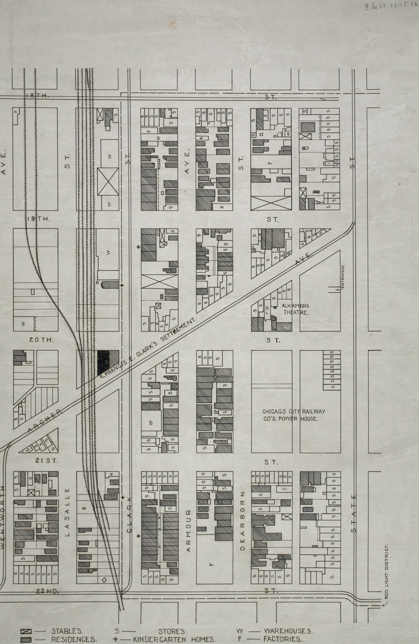
This is a historical map depicting an urban area with streets, buildings, and railroads. It includes details about various types of infrastructure and their locations. The map labels streets such as "18th St," "20th St," "21st St," "Ave E," and others. Railroads are marked prominently, cutting diagonally through the map.
Specific buildings and landmarks are shown and categorized using symbols and patterns. For instance:
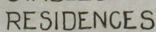
- Residences are marked with cross-hatching.
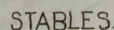
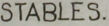
- Stables are represented by diagonal lines.
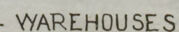
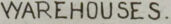
- Warehouses are labeled as "W."
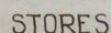
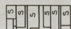
- Stores are marked as "S."
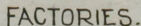
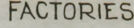
- Factories are marked as "F."
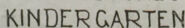
- Kindergarten homes are marked with a cross (+).
Notable landmarks include:
- "Larrabee St. Clerk's" near the railroad tracks.
- "Chicago City Railway Co.'s Power House" on the far right of the image.
- Alhambra Theatre on the bottom right corner, near "Red Light District" text.
The map likely represents a detailed layout of a neighborhood or district in a city, possibly during an early part of the 20th century.
Created by gpt-4o-2024-08-06 on 2025-06-14
The image is a detailed map of an urban area, depicting city blocks organized in a grid layout. Streets are labeled with avenues marked alphabetically, like "Ave E," and numbered streets such as "19th St" and "20th St." Key landmarks and buildings are annotated, with special patterns or symbols indicating different types of properties.
- Residences are indicated with a specific pattern, as are stables, stores, factories, warehouses, and kindergarten homes. For example, stables have a unique diagonal pattern, while stores, factories and warehouses are marked by "S", "F", and "W", respectively.
- The map highlights particular locations such as "Alhambra Theater," "Chicago City Railway Co's Power House," and "Larrabee Street."
- At the bottom, there's a legend clarifying the different symbols and patterns used to denote various types of buildings.
- Rail tracks are shown crossing through parts of the map, indicating the proximity of a rail yard or railway connection.
- The orientation of the map includes a compass rose in the bottom left corner, which aids in determining the directionality of the map's layout.
Overall, the map provides a snapshot of a neighborhood or district, highlighting residential, commercial, and industrial areas, as well as transportation infrastructure.
Anthropic Claude
Created by anthropic.claude-3-haiku-20240307-v1:0 on 2025-06-15
This image appears to be a detailed map or diagram of a city block or neighborhood. It shows the layout of various buildings and structures, including stables, stores, residences, kindergarten homes, warehouses, and factories. The map is divided into grid-like sections, with streets and avenues labeled. There is also a reference to the "Chicago City Railway Co.'s Power House" located in the area. The overall impression is that this is a detailed urban planning or architectural diagram, providing a comprehensive view of the buildings and infrastructure in this particular part of the city.
Created by us.anthropic.claude-3-5-sonnet-20241022-v2:0 on 2025-06-15
This is an architectural or city planning map showing several city blocks, likely from a historical period. The map spans from 19th Street to 22nd Street and shows various buildings and structures including:
- The Alhambra Theatre
- Chicago City Railway Co.'s Power House
- Various residential buildings (marked in a specific pattern)
- Stables (indicated in the legend)
- Stores
- Warehouses
- Factories
- Kindergarten homes
The map includes a legend at the bottom that differentiates between these different types of structures using different shading patterns. The streets are clearly marked, and there appears to be a diagonal street or path (possibly Clark's) cutting through some of the blocks. The layout is quite detailed, showing individual building plots and their uses within each block.
The map appears to be drawn in black and white, with different hatching patterns to distinguish between different types of buildings and land use. It's likely this was used for urban planning or property documentation purposes.
Meta Llama
Created by us.meta.llama3-2-11b-instruct-v1:0 on 2025-06-11
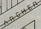
The image presents a detailed map of the area surrounding the Chicago City Railway's Power House, situated in the city of Chicago. The map is rendered in black and white, with various features and labels clearly visible.
Key Features:
- Railway Tracks: The map prominently displays the Chicago City Railway's tracks, which run diagonally across the center of the image. The tracks are labeled with the abbreviation "S.T." for "Street."
- Buildings and Structures: The map includes numerous buildings, including residences, stores, stables, kindergartens, warehouses, and factories. These structures are represented by small rectangles and squares, with some featuring additional details such as windows and doors.
- Street Names: The map features several street names, including 9th Street, 20th Street, 21st Street, Armour Street, Clark Street, Dearborn Street, and LaSalle Street. These streets are labeled in a clear and legible font.
- Avenues: The map also includes several avenues, including West Avenue, North Avenue, and South Avenue. These avenues are labeled with their corresponding directions (e.g., "W" for West).
- Alhambra Theatre: The map highlights the Alhambra Theatre, which is located near the intersection of 9th Street and Clark Street.
- Chicago City Railway's Power House: The map's title indicates that the map is centered around the Chicago City Railway's Power House, which is located near the intersection of 9th Street and Clark Street.
Overall:
The map provides a detailed and informative view of the area surrounding the Chicago City Railway's Power House. It offers a glimpse into the layout and features of the neighborhood during the late 19th or early 20th century, highlighting the presence of various buildings, streets, and landmarks.
Created by us.meta.llama3-2-90b-instruct-v1:0 on 2025-06-11
The image presents a detailed map of a neighborhood, showcasing its layout and features. The map is divided into sections, with each section containing various buildings, roads, and other elements.
Key Features:
- Buildings: The map displays a mix of residential and commercial buildings, including houses, apartments, stores, and factories.
- Roads: The roads are labeled with names such as "Clark's Settlement" and "Chicago City Railway Co.'s Power House."
- Other Elements: The map also includes symbols for stables, residences, stores, kindergartens, homes, warehouses, and factories.
Visual Representation:
- The map is presented in a grayscale format, with different shades used to distinguish between various features.
- The buildings are represented by rectangular shapes, while the roads are depicted as lines.
- The symbols for different elements are placed throughout the map, providing additional information about the neighborhood.
Overall Impression:
- The map provides a comprehensive view of the neighborhood's layout and features.
- It suggests that the neighborhood is a mix of residential and commercial areas, with a variety of buildings and amenities.
- The use of symbols and labels adds depth and detail to the map, making it a useful tool for understanding the neighborhood's characteristics.
Amazon Nova
Created by amazon.nova-lite-v1:0 on 2025-06-05
This image is a map of the area around 18th Street and Dearborn Street in Chicago, Illinois, from around 1880. The map shows the layout of the streets, buildings, and other structures in the area, including residences, stores, warehouses, factories, and stables. The map also includes a legend that identifies the different types of buildings and structures shown on the map. The map is drawn in black and white, with a grid-like pattern indicating the layout of the streets and buildings. The map appears to be an official document, possibly a city planning map or a real estate map.
Created by amazon.nova-pro-v1:0 on 2025-06-05
The image is a detailed map of a city block, likely from the early 20th century, showing various buildings and structures. The map is divided into several sections, each labeled with a street name and number. The streets are oriented in a grid pattern, with north at the top of the map. The map includes a legend in the bottom left corner, indicating the types of buildings and structures depicted. The buildings are represented by different symbols, such as rectangles for residential buildings, squares for commercial buildings, and triangles for factories. The map also includes a compass rose in the top left corner, indicating the direction of north. Overall, the map provides a detailed view of the urban landscape of the city block, showing the location and type of buildings and structures.
Google Gemini
Created by gemini-2.0-flash-lite on 2025-06-02
Here's a description of the image:
Overview:
The image is a detailed map of a city block layout, likely from the early 20th century, showing a grid of streets and various buildings. It appears to be a study of land usage, identifying the types of structures present.
Key Features & Details:
- Street Grid: The map features a typical city grid with streets running horizontally (e.g., 18th, 19th, 20th, 21st, 22nd Streets) and vertically (e.g., Wentworth Ave., LaSalle, Clark, Armour, Dearborn, State).
- Building Types: Buildings are represented with different symbols, indicated in a key at the bottom of the image:
- Residences: Appear to be the most common type, shown as rectangular shapes.
- Stores: Marked with "S."
- Kindergarten Homes: Marked with "+" symbols.
- Warehouses: Marked with "W."
- Factories: Marked with "F."
- Stables: Marked with a criss-cross pattern.
- Special Features:
- A railroad line runs diagonally across the map, suggesting the presence of a major transportation route.
- Several notable structures are labelled, including:
- "Alhambra Theatre"
- "Chicago City Railway Co.'s Power House"
- "Francis E. Clark's Settlement"
- "Red Light District"
- Scale: The map lacks a specific scale but the uniformity of street layout suggest that it is based on standardized city blocks.
Style & Context:
- The map is drawn in a simple, functional style with clear, bold lines.
- The image’s age is suggested by the architectural styles shown and the text. It is likely a survey or study of urban planning and demographic information.
Overall Impression:
The map is an informative snapshot of urban life in the late 19th or early 20th century. The type of buildings and the layout of the city reflect the industrial and social structures. It provides insights into the distribution of housing, businesses, and infrastructure, and the areas of industry, business, and recreation.
Created by gemini-2.0-flash on 2025-06-02
Here's a description of the image:
The image is a detailed map of an urban area, likely a section of a city. The map showcases streets, avenues, and buildings, with different types of establishments indicated by specific symbols. Key features include:
Streets and Avenues: The map clearly labels several streets and avenues, including Wentworth, LaSalle, Clark, Armour, Dearborn, State, 18th, 19th, 20th, 21st, and 22nd.
Railroad Tracks: A set of railroad tracks runs vertically through the western part of the map.
Francis E. Clark's Settlement: The location of this settlement is marked on the map.
Chicago City Railway Co's Power House: This building is clearly identified in the eastern section of the map.
Alhambra Theatre: The location of the theater is noted in the eastern section of the map.
Red Light District: The area is marked on the map.
Symbols and Legend: A legend at the bottom of the map explains the symbols used to represent different types of buildings:
- Striped/Hatched Buildings: Stables
- Solid White Buildings: Residences
- "S": Stores
- "+": Kindergarten Homes
- "W": Warehouses
- "F": Factories
The map is highly detailed, offering insights into the urban structure, land use, and key landmarks within the area depicted.
Mistral Pixtral
Created by us.mistral.pixtral-large-2502-v1:0 on 2025-06-05
The image is a detailed map of a section of an urban area, likely from the early 20th century, as indicated by the style and the types of buildings depicted. The map includes various streets, buildings, and landmarks, with specific symbols representing different types of structures.
Key features and details include:
Street Layout: The map shows a grid of streets with named avenues and streets. Notable streets include Clark Street, La Salle Street, Dearborn Street, and others.
Building Types: The map uses different symbols to denote various types of buildings:
- Stables are marked with a specific symbol.
- Residences are indicated with another symbol.
- Stores are shown with a different symbol.
- Kindergarten Homes are marked with a unique symbol.
- Warehouses are represented with another symbol.
- Factories are indicated with a distinct symbol.
Landmarks and Notable Buildings:
- Chicago City Railway Co's Power House: Located on the right side of the map.
- Chicago Telephone Co.: Located near the top right corner.
- Clark's Settlement: Mentioned along Clark Street.
Railway Lines: Several railway lines run through the area, intersecting with the streets and buildings.
Orientation: A compass rose in the top left corner indicates the direction, with north pointing upwards.
Scale: The map includes a scale bar, though the specific measurements are not clearly visible in the image.
The map provides a comprehensive view of the urban layout, including the distribution of different types of buildings and the infrastructure of the area. It is likely used for urban planning, zoning, or historical documentation purposes.
Qwen
Created by Qwen/Qwen2.5-VL-7B-Instruct on 2025-07-28
This image is a detailed plan or map of a neighborhood or district, likely from the early 20th century. It shows a grid of streets intersecting at right angles, with labels indicating the names of the streets. The map includes various symbols and labels for different types of buildings and infrastructure:
- Stables are marked with a cross symbol.
- Stores are indicated with an "S" symbol.
- Warehouses are denoted with a "W" symbol.
- Factories are represented with an "F" symbol.
- Residences are shown with a patterned symbol.
- Kindergarten homes are marked with a "+" symbol.
Key features visible in the map include:
- A railway line running through the area, marked with a dashed line and crossed with a "W" symbol, possibly for warehouses.
- The "Chicago City Railway Co.'s Power House" is noted towards the lower right.
- A "Red Light District" is indicated on the far right.
- The plan also includes mentions of specific locations or buildings, such as "Alhambra Theatre" and "Francis E. Clark's Settlement."
The map is detailed, suggesting it was used for urban planning or zoning purposes, and it includes a compass rose in the bottom left corner for orientation. The elements of the map, such as the street names and the detailed layout, suggest a focus on functionality and organization, typical of urban development plans from that time period.
Created by Qwen/Qwen2.5-VL-72B-Instruct on 2025-07-28
The image is a detailed map of a section of a city, likely from the early 20th century, given the architectural and typographic style. The map is oriented with a compass rose in the bottom left corner indicating north. The streets are labeled with names such as 18th, 19th, 20th, 21st, and 22nd Streets, as well as avenues like La Salle, Clark, and Dearborn.
The map uses various symbols to denote different types of buildings and structures:
- Stables are indicated with a specific symbol.
- Residences are marked with a different symbol.
- Stores are indicated by the letter "S."
- Warehouses are marked with the letter "WY."
- Factories are indicated by the letter "F."
- Kindergarten homes are marked with a plus sign (+).
Notable features include:
- The presence of railroad tracks running vertically through the center of the map.
- The "Alhambra Theatre" is labeled on the right side.
- The "Chicago City Railway Co's. Povery House" is also labeled on the right side.
- A section labeled "Red Light District" is located in the bottom right corner.
The map provides a detailed layout of the buildings and streets, with a focus on the types of structures present in this area of the city.
Text analysis
Amazon