LAMBY
MOORS
NEW
ELECTRIS POWER
ROAT H
TAFF Att RAHEWAHy
CEMETERY
ELECTRIC CAR
PARK
OAD
AFF
ARDRINGHAM ROAD
PARK
PENGAM
VALE
MAENDY
BARRACKS
RAIL
WARD
S
AY
ROATH COURT
ROAT H
INAUSHY
CA T H
OLENROYSSYHEEY
KEEBO
z
sWAR
R
WA
INPY ROAD
ANRY
H
NNY
WARD
FSTS
YARD
LL AND AFF
EYRAYHNATRN SY
OAKFIELDSY
VACKWEIR
RIVER
PARYRIDGE
TREEPARRIS
8AD
ST
M OORS
E A ST
LLAN DAFF
SENGHENN
CATHEDRAL
wHAREEE
SITES FOR
J
os a
/PiL O TT
CEN T RA
CATHAYS
PARK
PONTCANNA
WAR D
FIELDS
AN
PCANEY STA
LLANDAFF
vece
SOPHIA
GLIE
GARDENS
WAR D
ZALAH
FIELD
PLASTURTON AVRDE YDER
ADAL N s
COOPERS
CASTLE GARDENS
FIELDS
GAOL
RINGS
ST DAVID'S
GARDEN Ss
FIELD
OMILLY
OR
T
N T
A
C
RIVERSIDE
MILLY
HA
WORKHOUSE
ILTON
WARD
WESTOAT
S
A 1
A R
LYANE
OKE
A
ON
VICTORIA
MARK S
CARDIFF ARMS
REET
PARK
ROOKS
STEEL
WORKS
ACHEN
qUNSWICK
CRADDOC
HANOVER
AUNDD
CeAND
GREAT
WES TERN
wSHA
ALLEATON O'STREY
TOvENTEN O
BALT MARROAD
reneTON
RAIL WAY
VAL E
SOU. T
RAIL WAYY
SANITORIUM
W ARL
PARKEOND
R
CARDIFF UNION
scHOOL S
RACECOURSE
E LY
Sy
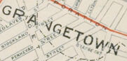
GPANGETOWN WARD
RIVER
73
REOL
OLAND
INPEVAD
ANKYEECY
RARRAC SYNEET
TACANS EYT
e
LECKWITH
PENARTH
BASIN
DOCK
COGAN
DOCKS
PAGE PLAE
OCK
AGHA
Map
NASGAREY ST
MOORS
N S
HOAD
OF
ALE
FEERY
CARDIFF
PLASSEYO37
CUBLOW S
GAS WORKS
WIN650
TAF
AD WINDSON TER
CARDIRF WEST
MOORS
RA
SCALE: 6 INCHES I MILE
MADFOND P
W.LEWIS.
BOOKSELLER & STATIONER
ORDNANCE MAP DEPOT
ECTPY
o6sCAND
CACH
TRAMWAYS SHEWN THUS
22, DUKE STREET CARDIFF
STATION
VICTORIA AY
F CTORIA
64
PENARTH
AdCHER R
RX
kRTHAN
AL
EAR
FUNIVERSITY SETLEMEN
AY
*RECE
ILTO
CHANNEL
HA
CARDIFF
VALE
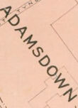
ADAMSDOWN
BRISTOL
UMPRIES a
BAILWAY
PE TEN
WARD
BUTE EAST
RVE R
LOCK
DOCK
B-U-T-E w
DOCK
ROATH
AMP
HARKET R
RESEOVOIR
OND
tSHIRE CA
CARDIFF
TIMBER
POND
ROATH BASIN
INGOLN
ALLDWORTH
SOUTH DOCK
CANTON
VIROIL
BASIN
PENARTH
BRANCH
HINGHAT
FARK E