Machine Generated Data
Tags
Color Analysis
Feature analysis
Amazon
Clarifai

AWS Rekognition
| Passport | 84.2% | |

Categories
Imagga
created on 2019-06-05
| text visuals | 50.7% | |
| paintings art | 49.2% | |
Captions
Microsoft
created by unknown on 2019-06-05
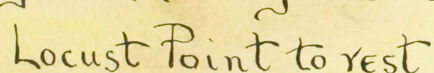
| a close up of a map | 49.8% | |
| close up of a map | 44.7% | |
| a map with text | 31.6% | |
Clarifai
No captions written
Salesforce
Created by general-english-image-caption-blip on 2025-05-05
a photograph of a map of a map of a map of a city
Created by general-english-image-caption-blip-2 on 2025-07-07
a map of the city of louisville, with the names of the city
OpenAI GPT
Created by gpt-4o-2024-11-20 on 2025-06-12
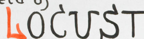
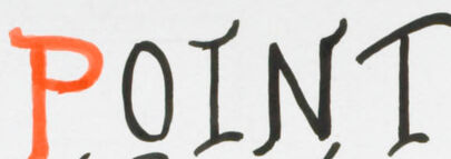
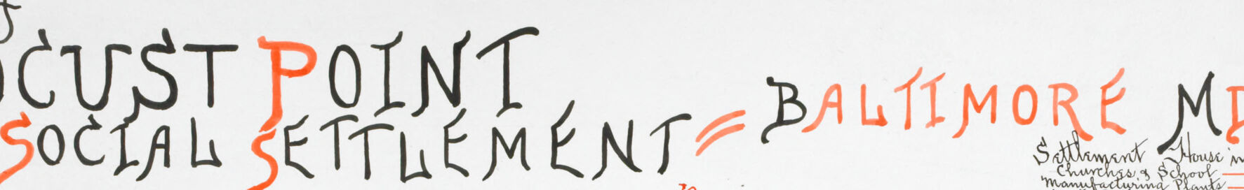
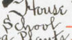
This image is a colorful, hand-drawn map illustrating the "Field of Locust Point Social Settlement" in Baltimore, Maryland. The map is a visual representation of the Locust Point area, detailing its features, landmarks, and layout. It includes both geographical and societal structures, marked with artistic lettering and vibrant colors.
Key features:
Title and Location:
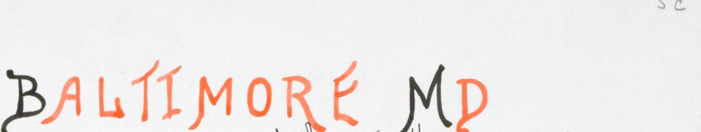
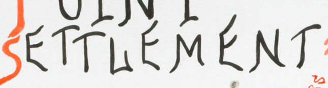
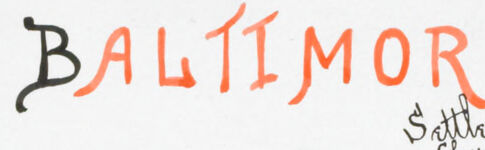
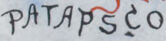
- At the top, the title prominently reads “Field of Locust Point Social Settlement – Baltimore MD.”
- Handwriting styles mix aesthetic curves and bold emphasis.
Geography:
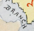
- The area is marked as a waterfront neighborhood, bordered by the Patapsco River and its Northwest Branch.
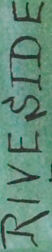
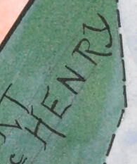
- Large lettering highlights notable landmarks such as Fort McHenry, Harbor Park, and Riverside Park, all shaded in green.
Infrastructure:
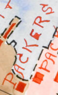
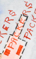
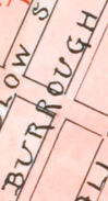
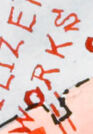
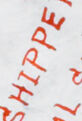
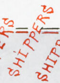
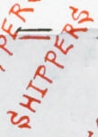
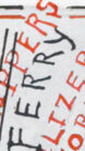
- Various streets and industrial areas are mapped out in detail, labeled with businesses (e.g., Tilers, Packers, Shipbuilders) and public locations.
- Important community sites, like churches, public schools, and athletic grounds, are clearly delineated.
Social Context:
- The map appears to emphasize urban planning and societal dynamics, showing connections between industrial, residential, and recreational spaces.
- Red dashed lines indicate boundaries or pathways, potentially showing routes or zones of interest.
Inset:
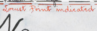
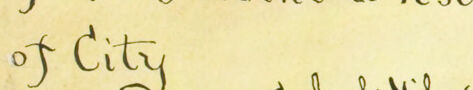
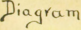
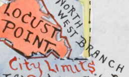
- A smaller inset in the bottom left corner provides a “Diagram showing relation of Locust Point to rest of city” for context within Baltimore.
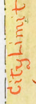
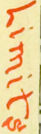
- This mini-map uses yellow shading and indicates city limits.
Artistic Details:
- Delicate watercolor hues—pink, light blue, green, and brown—add depth and help differentiate areas.
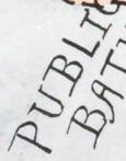
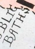
- Calligraphy adds charm, labeling locations with a hand-crafted aesthetic (e.g., Piers 8 & 9, Public Bath).
Focus on Community:
- The map reflects key community elements such as labor hubs, recreation, education, and transportation routes—all likely central to the social settlement.
Overall, this map is both functional and artistic, serving as a historical snapshot of Baltimore's Locust Point area and showcasing its social and geographical significance in early urban planning.
Created by gpt-4o-2024-08-06 on 2025-06-12
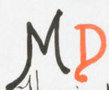
The image is a historical map depicting the area of Locust Point Social Settlement in Baltimore, Maryland. The map is hand-drawn with watercolor and ink, showcasing Locust Point and its surroundings. The map is titled "Field of Locust Point Social Settlement - Baltimore MD" and is signed by Frances Hagner.
Key features of the map include:
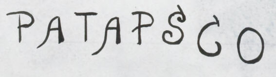
Geographical Layout: The map highlights the area known as Locust Point, bordered by the Patapsco River to the south and the Northwest Branch to the northeast. Fort McHenry is located on the east side at the water's edge.
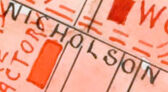
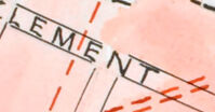
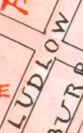
Infrastructure: Streets are depicted with various names such as Fort Ave, Clement St, and Hull St. It illustrates the layout of roads, railways, and piers 8-9 along the waterfront.
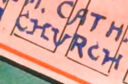
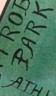
Landmarks: Important landmarks are marked in green, including Riverside Park, Latrobe Park & Bathing Grounds, and Catholic Church and Public School.
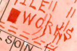
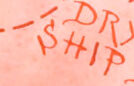
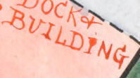
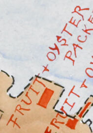
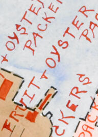
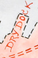
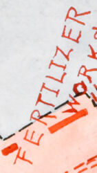
Industrial Zones: The area shows several industrial sites, such as fertilizer works, coal wharves, dry docks, shipbuilding facilities, oil curtains, oyster packers, and other manufacturing establishments.
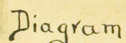
Insert Diagram: In the bottom left corner, there is a smaller diagram showing the relation of Locust Point to the rest of Baltimore City. It’s titled "Diagram showing relation of Locust Point to rest of City."
Color Coding: The use of color is prominent, with different shades illustrating different zones — residential, industrial, and recreational areas — primarily using blue, brown, red, and green hues.
Text and Symbols: The map uses various scripts and symbols to denote different areas and features. Decorative lettering styles are employed for the title and names.
Overall, this map provides an artistic and functional representation of the Locust Point area during the time it was created, focusing on urban geography and social interactions within the settlement.
Anthropic Claude
Created by anthropic.claude-3-haiku-20240307-v1:0 on 2025-06-15
The image appears to be a hand-drawn map or diagram showing the relationship between the Locust Point social settlement and the city of Baltimore, Maryland. The map includes various streets, neighborhoods, and landmarks within the city, as well as the Patapsco River. The text indicates that the Locust Point social settlement is located in the Baltimore area. The map provides a visual representation of the spatial organization and layout of this area.
Created by us.anthropic.claude-3-5-sonnet-20241022-v2:0 on 2025-06-15
This is a historical map showing the Locust Point area of Baltimore, Maryland, focused on social settlement. The map appears to be a detailed urban planning or survey document, with various streets and landmarks clearly marked. The Patapsco River is shown at the bottom of the map, and there are several notable features including:
- Fort Avenue running through the area
- Several parks marked in green
- A "Settlement House" indicated in the legend
- Various street layouts and building plots marked in red and black
- An inset diagram showing "relation of Locust Point to rest of City"
The map uses different colors to distinguish various zones and features:
- Green for parks and recreational areas
- Pink/red for developed areas
- Tan/beige for some sections
- Blue water features
The map appears to be focused on urban development and social planning in this particular Baltimore neighborhood, which was likely an important industrial and residential area during the period this map was created.
Meta Llama
Created by us.meta.llama3-2-11b-instruct-v1:0 on 2025-06-03
The image depicts a map of the Locust Point Social Settlement in Baltimore, Maryland. The map is hand-drawn and features a mix of orange, red, green, blue, and black ink, with some areas highlighted in yellow. The title "Field of Locust Point Social Settlement - Baltimore MD" is written in orange and black at the top of the map.
The map shows the location of various buildings, streets, and landmarks in the area. The buildings are represented by small rectangles or squares, and the streets are depicted as lines. The landmarks include a public bath, a playground, a school, and a church.
In the bottom-left corner of the map, there is a yellow rectangle with handwritten text that reads "Diagram showing relation of Locust Point to rest of City." This suggests that the map is intended to provide a visual representation of the settlement's location within the larger city of Baltimore.
Overall, the map appears to be a detailed and informative representation of the Locust Point Social Settlement, highlighting its layout and features. It may have been created for use by residents, visitors, or officials who needed to understand the settlement's geography and infrastructure.
Created by us.meta.llama3-2-90b-instruct-v1:0 on 2025-06-03
The image presents a map of the Locust Point area in Baltimore, Maryland. The map is titled "Field of Locust Point Social Settlement - Baltimore MD" and features a hand-drawn design with various colors and symbols.
Key Features:
- Title: The title is written in black and orange letters at the top of the map.
- Map Content: The map displays the layout of the Locust Point area, including streets, buildings, and landmarks such as the Patapsco River and Fort McHenry.
- Colors: The map uses a range of colors, including pink, green, yellow, and orange, to highlight different features and areas.
- Symbols: Various symbols are used throughout the map to represent different types of buildings, such as houses, factories, and schools.
- Annotations: The map includes handwritten annotations and notes, providing additional information about the area and its features.
Overall Impression:
The map appears to be a historical document, likely created in the early 20th century. It provides a detailed and colorful representation of the Locust Point area, highlighting its unique characteristics and features. The use of hand-drawn symbols and annotations adds a personal touch to the map, making it a valuable resource for historians and researchers interested in the history of Baltimore and its neighborhoods.
Amazon Nova
Created by amazon.nova-pro-v1:0 on 2025-06-02
The image is a vintage map of a social settlement in Baltimore, Maryland, titled "Field of Locust Point Social Settlement Baltimore, Md." The map is hand-drawn and colored, with various sections and labels indicating different areas and features within the settlement.
The map is divided into several sections, each with a distinct color and label. The main area of the settlement is shaded in pink, with various buildings and landmarks marked in different colors. The map also includes a diagram showing the relation of Locust Point to the rest of the city, with a scale of miles provided.
The map is surrounded by a border with the title and other text, including the name of the artist, Frances Haymes. The overall style of the map is reminiscent of early 20th-century cartographic design, with a focus on clarity and legibility.
The map appears to be a detailed and informative representation of the Locust Point Social Settlement, providing valuable information about the layout and features of the area.
Created by amazon.nova-lite-v1:0 on 2025-06-02
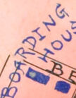
This is a map of the Locust Point Social Settlement in Baltimore, Maryland. The map shows the location of the settlement within the city, including the surrounding streets, buildings, and landmarks. The settlement is indicated by a gold star, and the map also includes information about the various institutions and organizations located within the settlement, such as schools, churches, and manufacturing plants. The map is hand-drawn and appears to be a historical document from the early 20th century.
Google Gemini
Created by gemini-2.0-flash on 2025-05-07
Here is a description of the image based on the OCR and visual details:
This is an old, hand-drawn map titled "Field of Locust Point Social Settlement, Baltimore, MD." It is an illustration, likely from a historical or sociological study. The map highlights the area of Locust Point in Baltimore, showing its layout and key features.
Here's a breakdown of the details:
Title and Location: The title is hand-lettered in a mix of orange, red, and black at the top of the map. "Baltimore, MD" is included to specify the location.
Map Details:
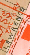
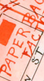
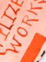
- The map depicts streets, parks, and various industrial features such as "Coal Shippers," "Fertilizer Works," "Fruit and Oyster Packers," "Glass Factory," and "Paper Bag Factory."
- Key landmarks like "Riverside Park," "Latrobe Park," and "Fort McHenry" are labeled.
- There are notations about settlements and houses indicated by "Gold Star" and schools indicated by "Blue Stars."
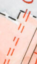
- Railroads are indicated with red dashed lines.
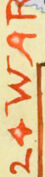
Inset Map: In the lower left, there's a smaller inset map that shows the relative location of Locust Point to the rest of Baltimore City. It labels the 24th Ward and surrounding waterways.
Waterways: The "Patapsco River" and the "North West Branch" are clearly marked.
Color Palette: The map uses watercolor to differentiate areas, with greens for parks, blues for water, and peach/orange tones to emphasize the Locust Point area.
City Limits: City Limits are shown as dotted lines.
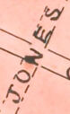
Signature: The name "Frances Haynes" appears in the lower right corner, likely the artist or creator of the map.
Overall, the map seems designed to provide a visual overview of Locust Point, highlighting its industrial character, social services ("Social Settlement"), and geographical context within Baltimore City.
Created by gemini-2.0-flash-lite on 2025-05-07
This is a detailed, hand-drawn map of the Locust Point neighborhood in Baltimore, Maryland, and its surrounding areas. The map highlights the "Social Settlement" aspect, likely pointing out the social resources available in the area.
Here's a breakdown of what's visible:
Title & Labels: The title "Field of Locust Point Social Settlement - Baltimore, MD" is prominent. The map uses handwritten lettering. There are also numerous labels indicating streets, businesses, and landmarks, such as:
- Riverside Park
- Fort McHenry
- Latrobe Park
- The Patapsco River
- Fertilizer Works
- Coal Shippers
- Packing factories
- Churches, Schools
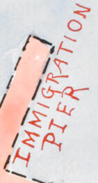
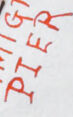
- Immigration Pier, Dry Docks
- Public Baths
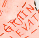
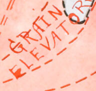
- Grain Elevators
Color Coding: The map seems to use different colors for different purposes. Red appears to highlight key infrastructure. Other details are colored blue and some areas are left uncolored.
Settlement Details: A legend indicates that settlements are marked with a "Gold Star".
Diagram of City Limits: A smaller diagram depicts the location of Locust Point within the larger city, including the Harbor and the Patapsco River.
Style: The map is not technically accurate. It uses a charming, artistic, and hand-drawn style. The map appears to be a snapshot in time, illustrating how the neighborhood was perceived and utilized at the time it was created.
Signatures: The lower right corner of the map includes the name "Frances Haynes."
Mistral Pixtral
Created by us.mistral.pixtral-large-2502-v1:0 on 2025-06-04
This image is a detailed map of the Locust Point Social Settlement in Baltimore, Maryland. The map highlights various aspects of the neighborhood, including streets, landmarks, and important locations.
Key features of the map include:
Geographical Boundaries:
- The map is bordered by the Northwest Branch and the Patapsco River.
- The eastern boundary is marked by the waterfront, including the Dry Dock and Ship Building area.
Streets and Areas:
- Major streets such as Fort Avenue, Clement Street, and Hull Street are clearly marked.
- Specific areas like Riverside Park and Fort McHenry are highlighted.
Landmarks and Points of Interest:
- The map shows the locations of various parks, including Riverside Park and the Athletic Grounds.
- Important buildings and facilities, such as the Dry Dock and Ship Building area, are indicated.
- Specific houses and buildings, like the Stillman's House, are marked with additional information about their historical significance.
Social and Community Features:
- The map includes details about the social settlement, indicating areas where different trades and activities took place, such as water packers, oyster packers, and coal shifters.
- The map also shows the locations of schools, churches, and other community facilities.
Inset Map:
- There is an inset map in the bottom left corner showing the relation of Locust Point to the rest of Baltimore, providing context for its location within the city.
Artistic Elements:
- The map is artistically rendered with a hand-drawn style, including watercolor elements that add visual interest and highlight different areas.
- The map is signed by "Frances Haysom" in the bottom right corner, indicating the creator.
Overall, the map provides a comprehensive view of the Locust Point Social Settlement, highlighting its geographical, social, and historical aspects.
Qwen
Created by Qwen/Qwen2.5-VL-7B-Instruct on 2025-07-28
This image depicts a map of the Locust Point Social Settlement in Baltimore, Maryland. The map is hand-drawn and appears to be a detailed illustration, possibly from the early 20th century, given the style of the writing and the annotations. It is labeled with various features and uses different colors to distinguish between different sections and types of establishments.
The map includes:
- A large shaded area in pink, which seems to represent the settlement itself, with various labels for different buildings and facilities within it.
- A section to the upper left is labeled "Riverside Park" in green, indicating a park area.
- The Patapsco River is prominently labeled at the bottom of the map.
- An inset map in the bottom left corner provides a more detailed view of the relationship of Locust Point to the rest of Baltimore, with labeled sections for different wards.
Notable labels on the map include:
- "Fruit Packers" and "Oyster Packers" near the top left.
- "Immigrant Boarding House," "Public School," and "Public Baths" within the main settlement area.
- "Grain Elevators" and "Dry Dock" on the right side of the settlement, near the river.
- "Fort Henry" is labeled in the bottom right corner, suggesting a military fortification.
The map also includes annotations about the settlement, such as the location of houses, churches, schools, manufacturing plants, and street railways, with different colors and lines used to distinguish these features. The overall style is somewhat dated, with a mix of handwritten and printed text, and the use of colored inks to highlight different areas.
Created by Qwen/Qwen2.5-VL-72B-Instruct on 2025-07-28
This image is a hand-drawn and hand-labeled map titled "Field of Locust Point Social Settlement - Baltimore MD." The map appears to depict the area around Locust Point in Baltimore, Maryland, and includes various landmarks, businesses, and geographical features.
Key elements of the map include:
- Locust Point Area: The central focus of the map, highlighted in pink, indicating the area served by the social settlement.
- Businesses and Industries: Numerous businesses are labeled, including "Fruit Packers," "Oyster Packers," "Coal Shippers," "Fertilizer Works," "Tile Works," "Pottery Works," "Glass Factory," "Paper Bag Factory," "Furniture Factory," "Grain Elevators," and "Dry Dock."
- Railways and Transportation: Red dashed lines represent railroads, and red solid lines indicate steam railways. The map also shows "Piers 8-9" and "Piers 6-7" along the waterfront.
- Public and Community Spaces: Notable locations include "Lavrobe Park Playground," "Athletic Grounds," "Public Baths," "Public School," and "Roman Catholic Church."
- Geographical Features: The Patapsco River is prominently labeled, and the Northwest Branch of the river is also indicated. The map shows the proximity of Fort McHenry.
- City Limits: A small inset map at the bottom left shows the relation of Locust Point to the rest of the city, with the city limits marked.
- Settlement House: The location of the settlement house is indicated by a gold star.
- Key Legend: The map includes a legend in the top right corner, explaining the symbols used for settlement houses, churches, schools, manufacturing plants, railroads, and steam railways.
The map is detailed and provides a comprehensive view of the industrial and social landscape of Locust Point in Baltimore. The hand-drawn style gives it a unique and historical feel.
Text analysis
Amazon