Machine Generated Data
Tags
Color Analysis
Categories
Imagga
| text visuals | 75.1% | |
| events parties | 17.7% | |
| streetview architecture | 6% | |
Captions
Microsoft
created on 2022-06-04
| diagram | 67.5% | |
Text analysis
Amazon


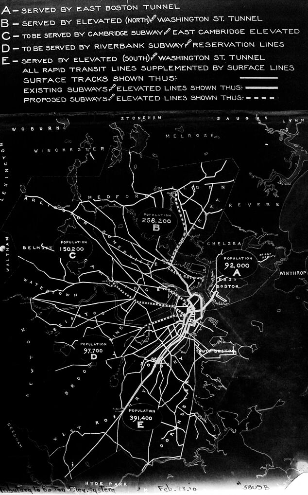


DateFebruary 23, 1910 |
|
PeopleArtist: Paul Rowell, American active 1898-1935 |
ClassificationPhotographs |
Credit LineHarvard Art Museums/Fogg Museum, Transfer from the Carpenter Center for the Visual Arts, Gift of the Massachusetts Bay Transportation Authority, Boston Transit Collection, 5.2002.602 |
|
| text visuals | 75.1% | |
| events parties | 17.7% | |
| streetview architecture | 6% | |
| diagram | 67.5% | |