
Machine Generated Data
Tags
Color Analysis
Feature analysis
Amazon
Clarifai
AWS Rekognition
| Rug | 74.4% | |

Categories
Imagga
created on 2022-01-22
| beaches seaside | 84.2% | |
| nature landscape | 9.6% | |
| text visuals | 2.8% | |
Captions
Microsoft
created by unknown on 2022-01-22
| a view of a beach | 79.9% | |
| a view through a window | 54% | |
| a close up of a window | 53.9% | |
Clarifai
Created by general-english-image-caption-clip on 2025-07-14
a city in the 1950s.
Salesforce
Created by general-english-image-caption-blip on 2025-05-18
a photograph of a black and white photo of a city with snow on the ground
OpenAI GPT
Created by gpt-4o-2024-11-20 on 2025-06-18
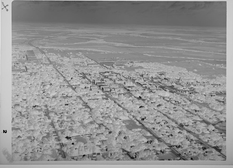
This image is a black-and-white aerial photograph of a town or city with a grid-like layout. The photo emphasizes contrast, creating a sharp depiction of structures and streets. Residential areas appear densely packed with trees scattered throughout. The town's center is distinguishable, with larger buildings and smokestacks likely indicating commercial or industrial zones. Surrounding the urban area are large expanses of open rural land or farmland, showcasing the transition from densely populated areas to wide stretches of undeveloped land. The composition suggests mid-20th century architecture and urban planning.
Created by gpt-4o-2024-08-06 on 2025-06-18
The image appears to be an aerial photograph of a large urban area, viewed from above at an angle. The foreground features a densely populated neighborhood with numerous buildings and houses, organized in a grid-like pattern with streets running between them. The buildings have a uniform appearance and are tightly packed, giving the impression of a well-developed residential area.
In the central portion of the image, there are larger structures that indicate a more commercial or industrial section of the city. These buildings are more spread out and include taller structures, likely representing a downtown or business district.
In the background, the landscape becomes more open, transitioning to what appears to be agricultural fields or less developed land. The image is in grayscale, giving it a vintage or historical feel. The clouds in the sky and the distant horizon are visible as well, providing a sense of depth and vastness to the surroundings.
Anthropic Claude
Created by anthropic.claude-3-haiku-20240307-v1:0 on 2025-06-20
The image appears to be an aerial photograph of a city or town. The scene shows a vast expanse of buildings and structures spread out across the landscape, with roads and other infrastructure visible. The image is in black and white, giving it a historical or archival feel. Without being able to identify any specific individuals or locations, the photograph provides a detailed overview of the urban area below, capturing the density and layout of the built environment from an elevated vantage point.
Created by us.anthropic.claude-3-5-sonnet-20241022-v2:0 on 2025-06-20
This is a black and white aerial photograph showing what appears to be a city or urban area from above. The image shows a dense pattern of buildings and streets laid out in a grid-like pattern. The buildings appear to be low-rise structures, and the photograph seems to have been taken from quite a high altitude, giving a broad view of the urban landscape. The surrounding area beyond the city appears to be more open or rural. The quality and style of the photograph suggests it may be a historical image, possibly from the mid-20th century. There's a measurement scale or reference marker visible along the edge of the photograph.
Meta Llama
Created by us.meta.llama3-2-11b-instruct-v1:0 on 2025-06-10
The image depicts a black and white aerial photograph of a town, likely taken from an airplane or drone. The town is situated in a valley, surrounded by snow-covered fields and mountains in the distance. The town itself is densely populated with buildings, roads, and trees, indicating a well-established urban area.
The photograph appears to be an old one, as evidenced by the grainy texture and the presence of a film border around the edges. The overall atmosphere of the image is one of serenity and tranquility, with the snow-covered landscape and the peaceful town creating a sense of calmness.
Created by us.meta.llama3-2-90b-instruct-v1:0 on 2025-06-10
The image presents a black-and-white aerial photograph of a town, showcasing its layout and infrastructure. The town is characterized by a grid-like pattern of streets, with trees lining the roads and surrounding buildings. In the foreground, a large body of water is visible, likely a river or lake, which adds to the town's scenic beauty.
The photograph appears to be an old or vintage image, given its black-and-white tone and the style of the buildings and infrastructure depicted. The overall atmosphere of the image suggests a peaceful and serene environment, with the town nestled among natural surroundings.
Amazon Nova
Created by amazon.nova-lite-v1:0 on 2025-06-08
The image is a black-and-white aerial photograph of a town. The town is composed of numerous buildings, many of which appear to be residential. The photograph captures a wide view of the town, with the buildings arranged in a grid-like pattern. The streets are visible, and the area is surrounded by fields or open land. The sky above is cloudy, adding a dramatic effect to the scene. The image has a historical feel, likely from the early to mid-20th century.
Created by amazon.nova-pro-v1:0 on 2025-06-08
The image is a black-and-white photograph of a city. The photograph is taken from a high altitude, showing the city's layout and infrastructure. The city is surrounded by a vast expanse of land, possibly a desert or a plain. The city has a grid-like street pattern, with buildings of varying sizes and shapes. The buildings are mostly rectangular, with some having a more complex design. The city is surrounded by a network of roads and highways, with some of them intersecting at right angles. The photograph has a vintage look, with a slightly grainy texture and a soft focus.
Google Gemini
Created by gemini-2.0-flash on 2025-05-16
Here is a description of the image:
The black and white image presents an aerial view of what seems to be a small town or neighborhood. The buildings are densely packed, appearing uniformly in the grayscale tone, and are interspersed with what is likely trees, their canopies also appearing as light patches across the landscape. This urban area stretches into the distance, where the terrain flattens into what could be open fields or plains, distinguished by patches of varying tones. The horizon is visible under a dark sky with light cloud cover. There is a sense of calm due to the stillness of the picture. There is a number "2" in the bottom left and a small "+" in the top left corner.
Created by gemini-2.0-flash-lite on 2025-05-16
Certainly! Here's a description of the image:
Overall Impression:
The image is a grayscale aerial view, likely a photograph. It depicts a town or small city in an expansive landscape. The photo has a slightly aged or vintage feel, likely due to the black and white format and the overall tone.
Key Elements:
- Town/City: The core of the image shows a grid-like structure of streets and buildings, indicating a developed area. There are areas that could be residential and others that may have commercial buildings.
- Vegetation: A significant amount of vegetation is present, likely trees, and adds texture to the built environment.
- Landscape: The town seems to transition into a more open landscape, possibly fields or farmlands, suggesting a rural or semi-rural setting.
- Sky: The sky appears somewhat overcast or hazy.
- Framing: The photo is set within a light-colored border, and the image is identified with a "2" in the bottom left and an "X" symbol in the top left.
Style and Tone:
The image suggests a sense of history, offering a view of a town or community likely captured decades ago. It has a somewhat documentary feel. The monochrome format gives it a classic, timeless appearance.
Mistral Pixtral
Created by us.mistral.pixtral-large-2502-v1:0 on 2025-06-03
The image appears to be an aerial photograph of a densely populated urban area, likely taken in a desert or arid region. Here are some key details:
Urban Layout: The city is characterized by a grid-like pattern of streets, with numerous buildings and structures closely packed together. The buildings appear to be mostly low-rise, possibly residential or small commercial properties.
Roads and Infrastructure: There are several prominent roads running through the city. These roads are relatively straight and wide, suggesting they are major thoroughfares or highways.
Surrounding Landscape: Beyond the urban area, the landscape transitions into a vast, flat, and barren expanse, indicative of a desert or arid environment. There are few visible features in the surrounding area, emphasizing the stark contrast between the city and its surroundings.
Vegetation: There is minimal visible vegetation within the city and almost none in the surrounding desert area. This further supports the idea that the region is arid.
Photographic Details: The photograph is in black and white, which could suggest it is an older image. The edges of the photo have some markings, possibly indicating it was taken for surveying or mapping purposes.
Overall, the image captures a densely built urban area situated in a desert or arid region, with clear demarcations between the city and the surrounding barren landscape.
Qwen
Created by Qwen/Qwen2.5-VL-72B-Instruct on 2025-07-15
This is a black-and-white aerial photograph of a city or urban area. The image shows a grid-like pattern of streets and buildings, suggesting a planned layout. The buildings appear to be densely packed, with many structures visible. The photograph also captures an expansive area of land beyond the urban center, which appears to be flat and possibly agricultural, as indicated by the presence of what could be fields or farmland. The horizon is visible, and the sky is clear. The image has a vintage quality, suggesting it might be from a past era. There are some markings or annotations on the photograph, including a circular symbol in the top left corner and some text in the bottom left corner.
Created by Qwen/Qwen2.5-VL-7B-Instruct on 2025-07-15
The image depicts an aerial view of a densely populated urban area. The photograph appears to be in black and white, giving it a historical or vintage feel. The city is characterized by a grid-like pattern of streets and buildings, suggesting a well-planned urban layout. In the foreground, there are numerous small structures, likely residential buildings, arranged in a tight, orderly fashion. Moving towards the center of the image, there is a larger concentration of larger buildings, possibly indicating a commercial or industrial area. In the background, the landscape transitions into what looks like a large body of water or an expanse of flat terrain, possibly snow-covered, given the monochromatic nature of the image and the snow-like appearance of the ground near the water. The overall impression is of a bustling cityscape surrounded by water, captured from an elevated perspective.
Text analysis
Amazon
